- Mid Yell
-
Coordinates: 60°36′N 1°04′W / 60.60°N 1.07°W
Mid Yell 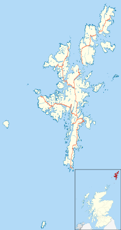
 Mid Yell
Mid Yell shown within ShetlandOS grid reference HU511910 Council area Shetland Lieutenancy area Shetland Country Scotland Sovereign state United Kingdom Post town SHETLAND Postcode district ZE2 Dialling code 01957 Police Northern Fire Highlands and Islands Ambulance Scottish EU Parliament Scotland UK Parliament Orkney and Shetland Scottish Parliament Shetland List of places: UK • Scotland • Mid Yell is a coastal settlement on the island of Yell, the second-largest of the Shetland Islands, Scotland.
Mid Yell, the largest settlement on the island, is at the head of Mid Yell Voe on the B9081 road about a mile from its junction with the A968 road.
External links
North Isles, Shetland Islands Inhabited islands 
Other islands Balta · Brough Holm · Gloup Holm · Haaf Gruney · Hascosay · Huney · Linga · Muckle Flugga · Out Stack · Sound Gruney · Urie Lingey · UyeaTowns and villages Aywick · Baltasound · Belmont · Burravoe · Copister · Cullivoe · Gloup · Gutcher · Houbie · Haroldswick · Mid Yell · Skaw · Ulsta · Uyeasound · West SandwickPoints of interest Belmont House · Brough Lodge · Burgi Geos · Daal of Lumbister · Hermaness · Muness Castle · Old Haa Museum · RAF Saxa Vord · Valhalla BreweryCategories:- Villages in Yell, Shetland
- Shetland geography stubs

Wikimedia Foundation. 2010.