- Oliver Paipoonge, Ontario
Infobox Settlement
official_name = Oliver Paipoonge
other_name =
native_name =
nickname =
settlement_type =
motto =
imagesize = 250px
image_caption = Oliver Paipoonge Municipal Hall
flag_size =
image_
seal_size =
image_shield =
shield_size =
city_logo =
citylogo_size =
mapsize =
map_caption =
mapsize1 =
map_caption1 =
image_dot_
flag_size =
image_
seal_size =
image_shield =
shield_size =
city_logo =
citylogo_size =
mapsize =
map_caption =
mapsize1 =
map_caption1 =
image_dot_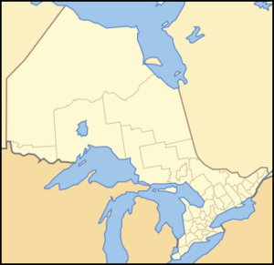
dot_mapsize = 250px
dot_map_caption = Location of PAGENAME
dot_x = 63 |dot_y = 138
pushpin_
pushpin_label_position =
pushpin_map_caption =
pushpin_mapsize =
subdivision_type = Country
subdivision_name =Canada
subdivision_type1 = Province
subdivision_name1 =Ontario
subdivision_type2 = Region
subdivision_name2 =Northwestern Ontario
subdivision_type3 = District
subdivision_name3 = Thunder Bay District
subdivision_type4 = CMA
subdivision_name4 = Thunder Bay
government_type =
leader_title =Mayor
leader_name =Lucia Kloosterhuis
leader_title1 =
leader_name1 =
leader_title2 =
leader_name2 =
leader_title3 =
leader_name3 =
leader_title4 =
leader_name4 =
established_title = Established
established_date = 1 January 1998
established_title2 =
established_date2 =
established_title3 =
established_date3 =
area_magnitude =
unit_pref =
area_footnotes =
area_total_km2 = 350.27
area_land_km2 =
area_water_km2 =
area_total_sq_mi =
area_land_sq_mi =
area_water_sq_mi =
area_water_percent =
area_urban_km2 =
area_urban_sq_mi =
area_metro_km2 =
area_metro_sq_mi =
population_as_of = 2006
population_footnotes =
population_note =
population_total = 5757
population_density_km2 = 16.4
population_density_sq_mi =
population_metro = 122907
population_density_metro_km2 = 48.19
population_density_metro_sq_mi =
population_urban =
population_density_urban_km2 =
population_density_urban_sq_mi =
timezone = EST
utc_offset = -5
timezone_DST = EDT
utc_offset_DST = -4
latd=48 |latm=23 |lats=24 |latNS=N
longd=89 |longm=31 |longs=12 |longEW=W
elevation_footnotes =
elevation_m =
elevation_ft =
postal_code_type = Postal code span
postal_code = P0T 1W0 Kakabeka Falls
P0T 2G0 Murillo
area_code = 807
website = [http://oliverpaipoonge.sencia.ca/ Municipality of Oliver Paipoonge]
footnotes =Oliver Paipoonge is a township in the Canadian province of
Ontario , located directly west of the city of Thunder Bay. The municipality was formed onJanuary 1 1998 , with the amalgamation of the former Township of Oliver and Township of Paipoonge. It contains several communities within its boundaries, including Kakabeka Falls, Murillo, Rosslyn, Slate River Valley and Stanley. The remainder of the municipality isagricultural or rural.The municipality is part of Thunder Bay's
Census Metropolitan Area .Politics
The municipal office of Oliver Paipoonge is located in the village of Murillo. The current
mayor of Oliver Paipoonge isLucia Kloosterhuis ; first elected as mayor in 2003, having previously served as a councillor in both Oliver Paipoonge and the former Township of Paipoonge. The first female elected as mayor in Oliver Township was Iris Calvert, in 1991. Previously, the Municipality of Paipoonge had not elected a female as mayor.Geography
The geography of Oliver Paipoonge transitions from river valleys in the south, through flat open farmland and rolling hills in the central areas, to the rough
Canadian Shield in the north. The most notable geographic feature isKakabeka Falls , located on the western edge of the municipality inKakabeka Falls Provincial Park .Transportation
The municipality is served by three major highways. Highways 61 and 130 are located in the southeast corner of the municipality and serves as the backbone of the Slate River Valley, an agricultural community. Highway 130 connects to the
Trans-Canada Highway (Highway 11/17) at Rosslyn, the largest settlement. It also serves as the main street for Kakabeka Falls. Approximately half of the population of Oliver Paipoonge lives within five kilometres of Highway 11/17. Highway 102 runs through the northeast corner of the municipality. A small grass airstrip is located northeast of Kakabeka Falls, and two rail lines run through the municipality.Economy
Oliver Paipoonge's primary industry is agriculture, followed with tourism focused around Kakabeka Falls and forest products manufacturing in Murillo and Rosslyn. Many residents commute to work either to Thunder Bay or the surrounding woodlands.
Communities
Murillo contains a post office, two stores, the Murillo Bakery featuring Rye Breads, a municipal hall, and a tavern. New commercial enterprises, located in the Rubin Industrial Park, include a well driller, self-storage facility, a forest products manufacturer, and the Rural Roots child care facility. Each year the village hosts the Murillo Fall Fair, which features chariot races.
The village is the location of the government offices for the Municipality of Oliver Paipoonge as well as the Oliver Paipoonge Police and the Lakehead Rural Planning Board.
Murillo was originally a
water stop on theCanadian Pacific Railway (CPR). The stop was named after the Spanish painterBartolomé Estéban Murillo , as the CPR was at that time using the names of painters to name the many new communities springing up along its trans-Canadian line. [Tronrud, Thorold J. & Nicholson, David (1999). " [http://www.thunderbaymuseum.com/publications.htm Thunder Bay Quiz Book: 101 Fascinating Questions about our History] ".Thunder Bay Historical Museum Society , pps. 9 (question) and 36 (answer) ISBN 0-920119-50-6.]Rosslyn contains numerous commercial enterprises and is home to approximately 1,000 people and the Paipoonge Museum. A new
golf course and housing subdivision, named King George's Park, are currently being developed in a formergravel pit. There is also a skating rink here, and a community centre beside it.Kakabeka Falls takes its name from the nearby
Kakabeka Falls waterfall. TheLauber Arboretum is located in the community.As Kakabeka Falls' economy is based on tourism, its main street is lines with tourist oriented businesses such as hotels, restaurants, and camping sites. A three-day
street fair is hosted in the village every August. Kakabeka Falls has a public school, called Kakabeka Falls Elementary School, located on the community's main street.Population and demographics
[http://www12.statcan.ca/english/Profil01/CP01/Details/Page.cfm?Lang=E&Geo1=CSD&Code1=3558011&Geo2=PR&Code2=35&Data=Count&SearchText=oliver%20paipoonge&SearchType=Begins&SearchPR=01&B1=All&Custom=] According to the 2001 census, there were 5,862 people residing in Oliver Paipoonge, of whom 51.2% were male and 48.8% were female. Children under five accounted for approximately 4.9% of the resident population of Oliver Paipoonge. This compares with 5.8% in Ontario as a whole, and almost 5.6% for Canada overall.
In mid-2001, 9.7% of the resident population in Oliver Paipoonge were of retirement age (65 and over for males and females) compared with 13.2% in Canada. The average age is 37.9 years of age comparing to 37.6 years of age for all of Canada.
In the five years between 1996 and 2001, the population of Oliver Paipoonge declined by 0.8% compared with an increase of 6.1% for Ontario province as a whole. Population density of Oliver Paipoonge averaged 16.7 people per square kilometre, compared with an average of 12.6 for Ontario altogether.
Religion
The 2001 census states that 81.2 per cent of Oliver Paipoonge residents belong to a
Christian (28.5%Roman Catholic , 50.1%Protestant , and 2.6% other Christian, mostly Orthodox) denomination. Those who follow religions likeBuddhism ,Judaism ,Islam , and others make up 1.5% of the population combined, while the remaining 17.3% are non-religious.ites of Interest
Each year Kakabeka Falls hosts a street fair, Murillo hosts the Murillo Fall Fair, the Slate River area hosts the Slate River Ploughing Match, and the Agriplex hosts an annual summer fair.
There are two museums in the municipality: the Paipoonge Museum in Rosslyn and the Pioneer Museum in the
Slate River Valley .Education
Oliver Paipoonge is served by the
Lakehead District School Board . There are three schools located in Oliver Paipoonge, Crestview Public School in Murillo, Kakabeka Falls Public School in Kakabeka Falls and Valley Central Public School. High schools students are bused to Thunder Bay. A daycare centre is located in Murillo.urrounding Municipalities
Canadian City Geographic Location (8-way)
Northwest = Kaministiquia
North = Thunder Bay, Unorganized
Northeast = Thunder Bay, Unorganized, Shuniah
West = Conmee, O'Connor
Centre = Oliver Paipoonge
East = Thunder Bay,Fort William First Nation
Southwest = Gillies, Nolalu
South = Neebing
Southeast = NeebingReferences
External links
* [http://www.oliverpaipoonge.on.ca Municipality of Oliver Paipoonge]
* [http://www.founders.ca/ Founders Museum and Pioneer Village]
* [http://www.ontarioparks.com/english/kaka.html Kakabeka Falls]
Wikimedia Foundation. 2010.