Olst

Olst
Olst

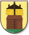
Coat of arms
Coordinates: 52°20′16″N 6°6′39″E / 52.33778°N 6.11083°E / 52.33778; 6.11083
Country Netherlands
Province Overijssel
Municipality Olst-Wijhe
Population (2004) 4,726

Olst is a village in the Dutch province of Overijssel. It is located in the municipality of Olst-Wijhe, about 7 km north of Deventer.

Until 2002, Olst was the seat of the municipality of the same name. The municipality was merged with that of Wijhe in 2001, keeping the name of the largest constituent part (Olst), until it was renamed Olst-Wijhe a year later.[1]

Transportation

  • Railway station: Olst

References

  1. ^ Ad van der Meer and Onno Boonstra, Repertorium van Nederlandse gemeenten, KNAW, 2006.

External links

Coordinates: 52°20′N 6°07′E / 52.333°N 6.117°E / 52.333; 6.117


Wikimedia Foundation. 2010.

Игры ⚽ Нужно сделать НИР?

Look at other dictionaries:

  • Olst — 52°20′16″N 6°6′39″E / 52.33778, 6.11083 …   Wikipédia en Français

  • Olst — Original name in latin Olst Name in other language State code NL Continent/City Europe/Amsterdam longitude 52.3375 latitude 6.10972 altitude 7 Population 4780 Date 2008 12 21 …   Cities with a population over 1000 database

  • Olst-Wijhe —   Municipality   …   Wikipedia

  • Olst-wijhe — Olst Wijhe …   Wikipédia en Français

  • Olst-Wijhe — Héraldique …   Wikipédia en Français

  • Olst railway station — Olst Station statistics Coordinates 52°20′06″N …   Wikipedia

  • Olst-Wijhe — Gemeinde Olst Wijhe Flagge Wappen Provinz Overijssel Bürgermeister …   Deutsch Wikipedia

  • Marle (Olst-Wijhe) — Pour les articles homonymes, voir Marle (homonymie). 52°24′49″N 6°7′37″E / …   Wikipédia en Français

  • Welsum (Olst-Wijhe) — 52°20′14″N 6°5′30″E / 52.33722, 6.09167 …   Wikipédia en Français

  • Holiday home Het Drostenerve Olst — (Olst,Нидерланды) Категория отеля: 4 звездочный отель Адрес: 8121C …   Каталог отелей

Share the article and excerpts

Direct link
Do a right-click on the link above
and select “Copy Link”