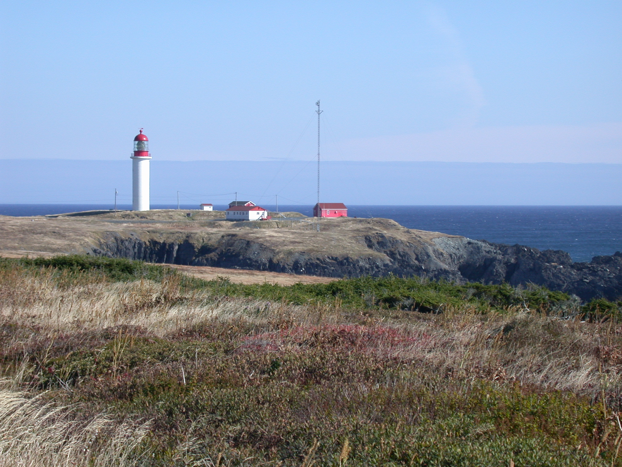
- Cape Race
Location map|Newfoundland
width=220
lon_dir=W
lat_dir=N
lat_deg = 46
lat_min = 39
lat_sec = 31.43
lon_deg = 53
lon_min = 04
lon_sec = 22.27
label = Cape Race
position = left
caption = Location of Cape Race in NewfoundlandCape Race is a point of land located at the southeastern tip of the
Avalon Peninsula on the island of Newfoundland,Canada . Its name is thought to come from the original Portuguese name for this cape, "Raso", or "bare". The Cape appeared on early sixteenth century maps asCape Raso and its name may derive from a cape of the same name at the mouth of theTagus River in Portugal.Geography
Dense fogs, rocky coasts, and its proximity to trans-
Atlantic shipping routes have resulted in manyshipwreck s near Cape Race over the years. One of the most famous was the SS|Arctic. Cape Race is a flat barren point of land jutting out into the Atlantic Ocean, its cliffs rising nearly vertically to 30.5 m (100 ft) above sea level. On average it is shrouded in fog on 158 days of the year. Located next to Trepassey.Lighthouse
caption = The second Cape Race Lighthouse from 1907
location = Southeastern Newfoundland
coordinates =
yearbuilt = 1907
yearlit =
automated =
yeardeactivated =
foundation =
construction = Concrete
shape = Cylindrical
marking = White with red lantern
height = convert|29|m|0|ft
elevation = convert|52|m|0|ft
lens = Hyperradiant Fresnel by Chance Brothers
currentlens =
intensity =
range = 24nautical mile s
characteristic = Fl. 7.5s
fogsignal = Horn (2) 60s
admiralty =H0444
NGA =1904
ARLHS =CAN-118In 1856, the first
lighthouse was installed by the British Government'sTrinity House . It was acast iron tower with a coal oil lamp turned byclockwork . It was replaced in 1907 by a 29 metres tall concrete tower and a light with a massivehyperradiant Fresnel lens made byChance Brothers inEngland . The original lighthouse was then moved to Cape North; it now stands in front of theCanada Science and Technology Museum inOttawa . The light's characteristic is a single white flash every 7.5 seconds, additionally afoghorn may sound a signal of two blasts every 60 seconds. There is also a high-power LORAN-C transmitter at Cape Race, whose mast was until the completion ofCN Tower the tallest structure of Canada.History
From 1859 to 1866, the
New York City Associated Press kept a newsboat at Cape Race to meet ocean liners passing by on their way from Europe so that news could betelegraph ed to New York. These news items carried the byline "via Cape Race".In 1904, the first
wireless station in Newfoundland was built at Cape Race. This was the major land-based locations that received the distress call from the RMS "Titanic", the other being, at least according to legend, the Marconi telegraph station on top of theWanamaker's department store in New York City. On the night the "Titanic" sank, wireless operatorJack Phillips was sending telegraphs to Cape Race for relay to New York City. When Cyril Evans, wireless operator of the SS "Californian", sent an iceberg warning to the "Titanic", only a few miles away, Phillips was annoyed with the loud signal (due to the proximity) and responded “Shut up, Shut up, I’m working Cape Race.” This would become a famous incident, as the bored Evans soon went to sleep, and "Titanic" hit an iceberg only fifteen minutes later. After "Titanic's" distress call, Cape Race played a major role in relaying news of the sinking to other ships and land locations.References
*cite web|url=http://www.unc.edu/~rowlett/lighthouse/nfle.htm|author=Rowlett, Russ|title=The Lighthouse Directory|accessdate=July 24|accessyear=2008
External links
* [http://titanic.gov.ns.ca/wireless.html Cape Race Wireless log at sinking of "Titanic" preserved at the Maritime Museum of the Atlantic, Halifax]
Wikimedia Foundation. 2010.

