- Cerro Gordo Township, Piatt County, Illinois
-
Cerro Gordo Township — Township — Location in Piatt County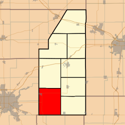
Coordinates: 39°51′28″N 88°40′45″W / 39.85778°N 88.67917°WCoordinates: 39°51′28″N 88°40′45″W / 39.85778°N 88.67917°W Country United States State Illinois County Piatt Established November 8, 1859 Area - Total 60.5 sq mi (156.69 km2) - Land 60.5 sq mi (156.69 km2) - Water 0 sq mi (0 km2) 0% Elevation 702 ft (214 m) Population (2000) - Total 2,199 - Density 36.3/sq mi (14/km2) Time zone CST (UTC-6) - Summer (DST) CDT (UTC-5) GNIS feature ID 0428783 Cerro Gordo Township is a township in Piatt County, Illinois, USA. As of the 2000 census, its population was 2,199.[1]
Contents
Geography
Cerro Gordo Township covers an area of 60.5 square miles (157 km2).
Cities and towns
Unincorporated towns
Extinct towns
- Burrowsville
- Lintner
Adjacent townships
- Willow Branch Township (north)
- Bement Township (northeast)
- Unity Township (east)
- Lovington Township, Moultrie County (south)
- Dora Township, Moultrie County (southwest)
- Long Creek Township, Macon County (west)
- Oakley Township, Macon County (west)
Cemeteries
The township contains four cemeteries: Cerro Gordo, Clover, County and LaPlace.
Major highways
 U.S. Route 36
 Illinois State Route 32
 Illinois State Route 105
Airports and landing strips
- White Landing Strip
References
External links
Municipalities and communities of Piatt County, Illinois County seat: Monticello City 
Villages Townships Bement | Blue Ridge | Cerro Gordo | Goose Creek | Monticello | Sangamon | Unity | Willow Branch
Unincorporated
communitiesGalesville | La Place | Lodge | Milmine | Pierson | White Heath
Footnotes ‡This populated place also has portions in an adjacent county or counties
Categories:- Townships in Piatt County, Illinois
- 1859 establishments in the United States

Wikimedia Foundation. 2010.