- Doueir
-
Doueir
دوير— City — Location within Lebanon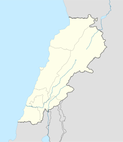
 Doueir
Coordinates: 33°23′11″N 35°24′52″E / 33.38639°N 35.41444°ECoordinates: 33°23′11″N 35°24′52″E / 33.38639°N 35.41444°E Country  Lebanon
Governorate Nabatieh Governorate District Nabatieh District Government - Mayor Fouad Mohammad Rammal[1] Area - Total 10 km2 (3.9 sq mi) Elevation 420 m (1,378 ft) Time zone EET (UTC+2) - Summer (DST) EEST (UTC+3) Postal code Dialing code +961 Doueir (Arabic: دوير, al-Dwayr), or Dweir, is a village of 7,500 inhabitants in Southern Lebanon near Nabatiyeh and north of the Litani River. Although Doueir is a small village, it is the home of many well-known Lebanese such as former Labour minister Ali Qanso, Mahdi Kanso, and Rammal Rammal.
During the 2006 Lebanon War, Doueir was among the first targets of the IDF, with a family of 12 killed on July 13.[2][3][4] The village has since benefited from investment by the Italian government to build a new olive oil mill.[5]
References
- ^ Mayors want environmentally friendly waste treatment system
- ^ Report of the Commission of Inquiry on Lebanon pursuant to Human Rights Council resolution S-2/1
- ^ Blanford, Nicholas; Stephen Farrell (July 14, 2006). "Two sides — one war". The Times (London). http://www.timesonline.co.uk/tol/news/world/middle_east/article687573.ece. Retrieved 14 January 2009.
- ^ Commission of Inquiry on Lebanon - Attacks on civilians and civilian objects - Doueir
- ^ "Italy funds new olive mill, generator in southern town". Daily Star (Lebanon). 26 August 2008. http://www.dailystar.com.lb/article.asp?edition_id=1&categ_id=2&article_id=95393. Retrieved 14 January 2009.
External links
Categories:- Nabatieh District
- Populated places in Lebanon
- Lebanon stubs

Wikimedia Foundation. 2010.