- Silers Bald
Infobox Mountain
Name = Silers Bald
Photo = Silers-bald-from-narrows1.jpg
Caption=The summit of Silers Bald, looking west from the Narrows.
Elevation = 5,607 feet (1709 metres)
Range =Great Smoky Mountains
Location = Tennessee, USA
Prominence = 337 feet (102 metres) [http://www.peakbagger.com/peak.aspx?pid=7762]
Coordinates = 35.566139, -83.565651
Topographic
USGS Silers Bald
Easiest route = Appalachian Trail west from Clingmans Dome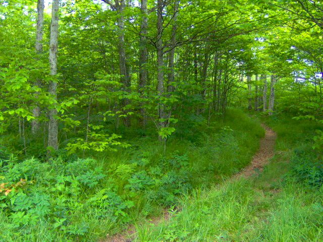
right|250px|thumb|What was once a massive grazing land has reverted to patches of meadow and young woodland on the western slope of Silers BaldSilers Bald is a mountain in the western
Great Smoky Mountains , located in the Southeastern United States. Its proximity toClingmans Dome and its location alongtheAppalachian Trail make it a popular hiking destination.Silers Bald is located on the crest of the Smokies with
Thunderhead Mountain to the west andClingmans Dome to the east. The Tennessee-North Carolina state line crosses the summit, with the mountain split evenly between Sevier County,Tennessee to the north andSwain County ,North Carolina to the south. Silers Bald rises appx. 2,500 feet above its northern base near Fish Camp Prong (of Little River), and appx. 3,000 feet above its southern base near Forney Creek.While Silers Bald was a grassy bald for most of the 19th and early-20th centuries, it was probably a wooded peak before the arrival of European settlers. For this reason, the park service does not maintain the bald atop the mountain (the
Great Smoky Mountains National Park currentlymaintains only two grassy balds—Gregory Bald andAndrews Bald ). [Daniel Pierce, "The Great Smokies: From Natural Habitat to National Park" (Knoxville: University of Tennessee Press, 2000), 178.] A narrow corridor fortheAppalachian Trail , which crosses the summit, is kept clear for thru-hikers. There is stilla small bald area at the summit, approximately 30 feet in diameter, where the AppalachianTrail makes a 90-degree turn. Several grassy meadows remain on the mountain's western slope.Geology
Silers Bald consists of Thunderhead sandstone, a small pile of which crowns the summit. This sandstone, part of the Ocoee Supergroup, was formed from ocean sedimentsnearly a billion years ago. The mountain, like most of the Smokies, was formed some200 million years ago when the North American and African plates collided during the
Appalachian orogeny , pushing the rock upward. [Harry Moore, "A Roadside Guide to the Geology of the Great Smoky Mountains National Park" (Knoxville: University of Tennessee Press, 1988), 26-27.]History
While Silers Bald is hardly mentioned in Cherokee lore, a
petroglyph was discovered nearthe summit in 1917. [Robert Mason, "The Lure of the Great Smokies" (Boston and New York: Houghton-Mifflen, 1927), 44.] The mountain's elevation is probably recorded byArnold Guyot during his 1859 survey of the Smokies crest, but under a different name (possibly Guyot's "Big Stone Mountain," which Guyot listed with an elevation of 5614 feet and lying somewhere between Mt. Buckley and Thunderhead). [Robert Mason, "The Lure of the Great Smokies" (Boston and New York: Houghton-Mifflen, 1927), 55-56.]Silers Bald is named after Jesse Siler, a prominent North Carolinian who grazed sheepand cattle atop the mountain in the 1800s. Likewise, Siler Bald, in the NantahalaMountains to the south, was named after Jesse's brother, William. Albert Mountain,also to the south, was named after Jesse's nephew, Albert Siler. [Larry Luxenberg, "Walking the Appalachian Trail" (Mechanicsburg, Penn: Stackpole Books, 1994), 25.]
By the late 1800s, Silers Bald was the far eastern end of a giant grassy pasture thatstretched several miles across the Smokies' western ridge all the way to Russell Field, which overlooks
Cades Cove . [Carson Brewer, "Great Smoky Mountains National Park" (Portland, Ore: Graphic Arts Center Publishing, 1993), 21.] The mountain is mentioned several times in Horace Kephart's "Our Southern Highlanders" as the last stop before one enters a heavily-wooded wilderness. [Horace Kephart, "Our Southern Highlanders" (Knoxville: University of Tennessee Press, 1976), 64, 214, e.g.] According to Kephart, beyond "Hall cabin" (a herder's shack near modern Big Chestnut Bald, six miles east of Thunderhead):...there is just one shack, at Siler's Meadow. It is down below the summit, hidden in timber, and you would never have seen it. Even if you had, you would have found it as bare as a last year's mouse nest, for nobody ever goes there except for a few bear-hunters. From there onward for forty miles is an uninhabited wilderness so rough that you could not make seven miles a day in it to save your life..." [Horace Kephart, "Our Southern Highlanders" (Knoxville: University of Tennessee Press, 1976), 64.]
Laura Thornborough, a writer who visited Silers Bald in the 1930s, recalls it as a giant meadow:
Silers is one of the mysterious grassy balds, or mountain-top meadows, and an outstanding vantage point commanding spectacular views. [Laura Thornborough, "Great Smoky Mountains" (Knoxville: University of Tennessee Press, 1942), 124.]
Access
The easiest access to Silers Bald is to take the
Clingmans Dome tower trail from theForney Ridge Parking Lot to the tower. From there, following theAppalachian Trail westfor just over four miles brings one to the summit of Silers Bald. This leg of the trail is riddledwith elevation gain and loss, crossing Mt. Buckley (a knob of Clingmans Dome), JenkinsKnob, and a sparsely-wooded ridge known as "The Narrows".At the summit of Silers Bald, an unmarked spur trail winds several yards to a cliff on the northwest slope of the mountain. This cliff offers a 180-degree view of the northernSmokies, with a clear shot of Mount Le Conte to the east and
Thunderhead Mountain to the west.References
External links
* [http://www.nps.gov/grsm/planyourvisit/upload/trails2005.pdf Great Smoky Mountains National Park Trail Map] - Large file in .pdf format.
* [http://www.peakbagger.com/peak.aspx?pid=7762 Silers Bald] - Peakbagger.com
* [http://www.silersbald.com Silers Bald] - a Christian rock band that took its name from the mountain.
* [http://www.cs.utk.edu/~dunigan/at/m.php?wpt=SilersBal Silers Bald Shelter] - one of the better backwoods shelters along the
Appalachian Trail * [http://www.vorvax.com/brianphotos/images/silersbald.html Silers Bald] - a photo gallery by Brian Stansberry
Wikimedia Foundation. 2010.