- Devonport Leat
-
Coordinates: 50°34′49″N 3°57′43″W / 50.5802°N 3.9620°W
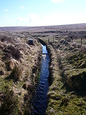
The Devonport Leat was a leat constructed in the 1790s to carry fresh drinking water from the high ground of Dartmoor to the expanding dockyards at Devonport, Devon, England. It is fed by three Dartmoor rivers: the West Dart, the Cowsic and the Blackabrook. It was originally designed to carry water all the way to Devonport Dockyard, but has since been shortened and the operational part of the leat now stops near the Burrator dam. The water goes via underground pipes to the water treatment works at Dousland with the excess going into the Burrator Reservoir which provides most of the water supply of Plymouth. For part of the route to Dousland the pipes utilise the route of the old Plymouth Leat and the route of the disused Yelverton to Princetown Railway. Prior to the installation of the piped supply to Dousland the water was used for a hydro electric turbine located near Yelverton Reservoir and fed by a 12-inch-diameter (300 mm) pipe.
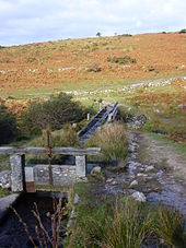
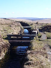
Dartmoor granite was used to construct the water channel, as well as a small aqueduct and a tunnel. It is possible to follow the path of the leat all the way from the beginning to the end of its path apart from one section where it passes through a tunnel.[dubious ]
Route
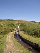
The Devonport Leat begins a short distance to the north of Wistman's Wood and passes close to Two Bridges before heading towards Princetown. Its water supply now ends up in Burrator Reservoir.[1] Judging by a map it might appear to follow a meandering path across the moor, but the route was carefully selected by skilled engineers, who followed the natural contours of the land. Near the source of the leat there is a curious optical illusion; viewed from the opposite bank of the West Dart River between Two Bridges and Wistman's Wood, it appears to flow uphill.
See also
References
- Hawkings, David J. (1987). Water from the Moor. Devon Books. pp. 50–71. ISBN 0-86114-788-X.
Categories:- Dartmoor
- Aqueducts in England
Wikimedia Foundation. 2010.


