- Norton Canes
-
Coordinates: 52°41′00″N 1°58′00″W / 52.683333°N 1.966667°W
Norton Canes 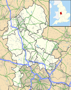
 Norton Canes
Norton Canes shown within StaffordshireOS grid reference SK010079 District Cannock Chase Shire county Staffordshire Region West Midlands Country England Sovereign state United Kingdom Postcode district WS11 Police Staffordshire Fire Staffordshire Ambulance West Midlands EU Parliament West Midlands UK Parliament Cannock Chase List of places: UK • England • Staffordshire Norton Canes is a village and civil parish on the southern periphery of Cannock Chase District, in Staffordshire, England. It is situated 3 miles (4.8 km) out of the centre of Cannock. At the 2001 census it had a population of 6,394.[1] and an area of 3,746 acres (15.16 km2) of which 86% is green open space.
The Cannock Chase Coalfield once had 45 collieries within 2 miles (3.2 km) of Norton Canes, employing over 5,800 men, as well as 2 large surface mines; the last pit in the area closed in 1993. One colliery was owned by the Jerome family, hence Jerome Road now on the site of the pit. This was the family of the author Jerome K. Jerome. Norton Canes borders Chasewater - a collection of man-made lakes formed through old mining pits and a reservoir that feeds the canal system of West Midlands. Chasewater is a popular leisure destination offering facilities for water-skiing and yachting, mountain biking, jogging, walking and bird watching.
Norton Canes straddles the UK's first and only Toll Motorway, the M6 Toll which has its northern Toll Plaza and Norton Canes Services is the only services for that motorway. (Norton Canes Services).
Norton Canes is home to Europe's first drive-through chemist.
Schools
There are two primary schools in Norton Canes: Jerome Primary School and Norton Canes Primary School. There is one high school: Norton Canes High School.
References
- ^ C http://www.staffordshire.gov.uk/NR/rdonlyres/8541174 C-7ECB−4763-9BDE-A9819AE6E865/22602/chasewardssocial. pdf
External links
Categories:- Cannock Chase
- Villages in Staffordshire
- Civil parishes in Staffordshire

Wikimedia Foundation. 2010.