- Meghauli Airport
-
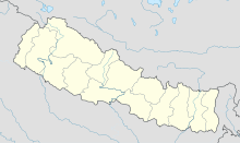
Meghauli Airport IATA: MEY – ICAO: VNMG Location of airport in Nepal Summary Airport type Public Serves Meghauli, Nepal Elevation AMSL 600 ft / 183 m Coordinates 27°34′38″N 84°13′44″E / 27.57722°N 84.22889°E Runways Direction Length Surface m ft 1,085 3,560 Source: [1] Meghauli Airport (IATA: MEY, ICAO: VNMG) is an airport serving Meghauli,[1] a village in the Chitwan district of the Narayani zone in southern Nepal.
Contents
Facilities
The airport resides at an elevation of 600 feet (183 m) above mean sea level. It has one runway which is 1,085 metres (3,560 ft) in length.[1]
Airlines & Destinations
Airlines Destinations Tara Air Kathmandu [2] References
- ^ a b c Airport information for Meghauli, Nepal (VNMG / MEY) at Great Circle Mapper.
- ^ http://www.taraair.com/
External links
Categories:- Airports in Nepal
- Narayani Zone
Wikimedia Foundation. 2010.

