- Oregon Route 332
-
Oregon Route 332
Route information Maintained by ODOT Length: 7.93 mi (12.76 km) Existed: 2003 – present Major junctions West end: State Line Road near Umapine  OR 339 near Milton-Freewater
East end:  OR 11 near Milton-Freewater
Highway system Oregon highways
Routes • Highways←  OR 331
OR 334  →
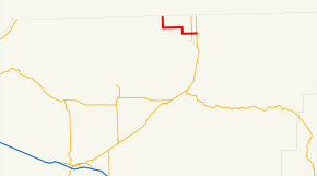
→Oregon Route 332 (OR 332) is an Oregon state highway running from the Washington state line near Umapine to OR 11 near Milton-Freewater. OR 332 is known as the Sunnyside-Umapine Highway No. 332 (see Oregon highways and routes). It is approximately eight miles long and runs east–west, entirely within Umatilla County.
OR 332 was established in 2003 as part of Oregon's project to assign route numbers to highways that previously were not assigned, and, as of July 2010, was unsigned.
Contents
Route description
OR 332 begins at an intersection with State Line Road on the Washington state line two miles (3 km) north of Umapine and heads south and then east toward Milton-Freewater, passing through Sunnyside. Near Milton-Freewater, OR 332 crosses OR 339 and proceeds east. Approximately one mile north of Milton-Freewater, OR 332 ends at an intersection with OR 11.
History
OR 332 was assigned to the Sunnyside-Umapine Highway in 2003.
Major intersections
Milepost City Intersection Approx. 0.00 Near Umapine State Line Road at Washington state line (Begin route) 7.15 Near Milton-Freewater OR 339 7.93 Near Milton-Freewater OR 11 References
- Oregon Department of Transportation, Descriptions of US and Oregon Routes, http://www.oregon.gov/ODOT/HWY/TRAFFIC/TEOS_Publications/PDF/Descriptions_of_US_and_Oregon_Routes.pdf, page 29.
- Oregon Department of Transportation, Oregon-Washington Highway No. 8, ftp://ftp.odot.state.or.us/tdb/trandata/maps/slchart_pdfs_1980_to_2002/Hwy008_2001.pdf
- Oregon Department of Transportation, Freewater Highway No. 339, ftp://ftp.odot.state.or.us/tdb/trandata/maps/slchart_pdfs_1980_to_2002/Hwy339_1996.pdf
Categories:- State routes in Oregon
- Transportation in Umatilla County, Oregon


Wikimedia Foundation. 2010.