- Naila
-
Naila 

 NailaLocation of the town of Naila within Hof district
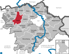
Coordinates 50°19′N 11°41′E / 50.31667°N 11.68333°ECoordinates: 50°19′N 11°41′E / 50.31667°N 11.68333°E Administration Country Germany State Bavaria Admin. region Upper Franconia District Hof Mayor Frank Stumpf (FW) Basic statistics Area 37.05 km2 (14.31 sq mi) Elevation 512 m (1680 ft) Population 8,071 (31 December 2010)[1] - Density 218 /km2 (564 /sq mi) Other information Time zone CET/CEST (UTC+1/+2) Licence plate HO Postal code 95119 Area code 09282 Website www.naila.de 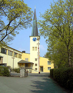 Naila: The Church of the Transfiguration
Naila is a town in the Frankenwald hills, in the Hof district of Bavaria. Naila is situated some 18 km from the larger city of Hof.
Contents
History
The earliest documentation of Naila dates at 1.9.1343. The first settlements in the area around Naila probably happened between the 12. and 14. century. The name Naila which first appeared as "Neulins" and variations thereof, has its origins most likely in the meaning "Small new settlement".
Up until 1972 it was the seat of the then district of Naila. The village of Marxgrün incorporated to Naila in 1978.[citation needed]
After WW2 the Iron Curtain, just 8 km north of Naila, cut off a large part of the market for the local industries.
See also: German Wikipedia
- Naila
- Frankenwald (Frankonian forrest)
- Wilder Mann (Wild Man)
- Das Höllental (Hell-Valley)
- the river Selbitz
External links (German)
- Map of Naila
- History of the city-seal
- Description of the balloon-escape from the GDR
- official website of the city of Naila
Towns and municipalities in Hof Bad Steben | Berg | Döhlau | Feilitzsch | Gattendorf | Geroldsgrün | Helmbrechts | Issigau | Köditz | Konradsreuth | Leupoldsgrün | Lichtenberg | Münchberg | Naila | Oberkotzau | Regnitzlosau | Rehau | Schauenstein | Schwarzenbach am Wald | Schwarzenbach an der Saale | Selbitz | Sparneck | Stammbach | Töpen | Trogen | Weißdorf | Zell im Fichtelgebirge
References
- ^ "Fortschreibung des Bevölkerungsstandes" (in German). Bayerisches Landesamt für Statistik und Datenverarbeitung. 31 December 2010. https://www.statistikdaten.bayern.de/genesis/online?language=de&sequenz=tabelleErgebnis&selectionname=12411-009r&sachmerkmal=QUASTI&sachschluessel=SQUART04&startjahr=2010&endjahr=2010.
Categories:- Towns in Bavaria
- Hof district
- Upper Franconia geography stubs


Wikimedia Foundation. 2010.