- Cheam Range
-
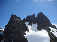
Cheam Range Range  Cheam Peak, seen from Lady Peak
Country Canada Province British Columbia Part of Skagit Range, Canadian Cascades City Vancouver, British Columbia Highest point Welch Peak - elevation 2,431 m (7,976 ft) - coordinates 49°09′36″N 121°36′02″W / 49.16°N 121.60056°W Area 112 km2 (43 sq mi) The Cheam Range is a mountain range in the Fraser Valley region of the Lower Mainland of British Columbia near the town of Chilliwack. The region is also a part of the Skagit Range of the Canadian Cascades and contains many rugged peaks.
The western peaks in the range - Cheam, Lady, Baby Munday and Stewart, are known in areas of the Fraser Valley where there are visible, as the "Four Sisters". The eastern peaks in the range are referred to as the Lucky Four Group because of their proximity to the abandoned Lucky Four Mine[1][2][3]; the glacier in the cirque formed by Welch and Foley is called the Lucky Four Glacier. Foley, Welch and Stewart commemorate partners in Foley, Welch and Stewart, an important contractor in early British Columbia responsible for building the Pacific Great Eastern Railway and other projects.
Peaks
- Cheam Peak
- Lady Peak
- Knight Peak
- Baby Munday
- Stewart Peak
- The Still
- Welch Peak
- Foley Peak
Notes
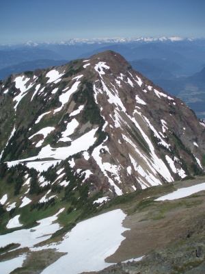
 Baby Munday Peak, seen from near the summit of Knight Peak.
References
- "Cheam Range". BC Geographical Names. http://apps.gov.bc.ca/pub/bcgnws/names/42344.html.
- "Cheam Range". Canadian Mountain Encyclopedia. http://www.canadianmountainencyclopedia.com/ArxPg.asp?ArxId=166. Retrieved 2007-02-18.
- Fairley, Bruce (1986). "Chapter 24 The Cheam Range". A Guide to Climbing and Hiking in Southwestern British Columbia. Gordon Soules Book Publishers Ltd.. pp. p287. ISBN 0-919574-99-8.
- Beckey, Fred (1995). "Section I: Northwestern Cascade Range". Volume 3: Rainy Pass to Fraser River. Cascade Alpine Guide, Climbing and High Routes. The Mountaineers, Seattle, WA. pp. pp144–152. ISBN 0-89886-423-2.
Categories:- Mountain ranges of British Columbia
- Lower Mainland
- Canadian Cascades
- British Columbia Coast geography stubs

Wikimedia Foundation. 2010.