- Caraguatatuba
Infobox City
official_name = Caraguatatuba
native_name =
nickname = "Caraguá"
motto = "Duc in Altum"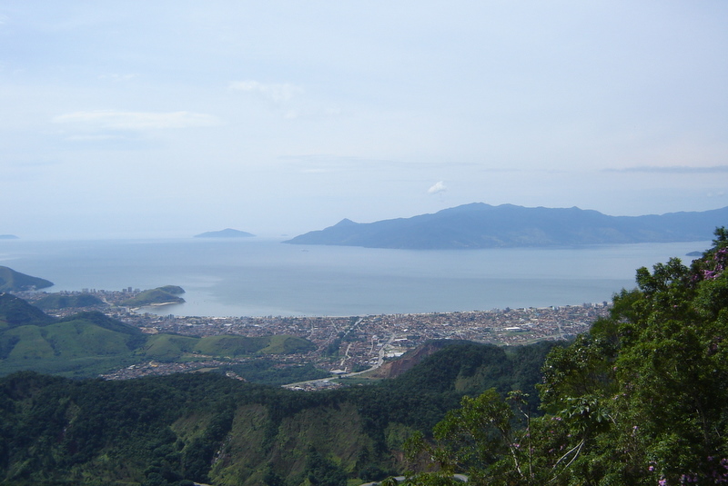
imagesize =
image_caption = View of downtown Caraguatatuba withIlhabela at background.
image_
mapsize =
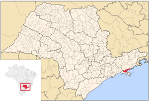
map_caption = Location in the state of São Paulo andBrazil
subdivision_type = Country
subdivision_name =Brazil
subdivision_type1 = Region
subdivision_name1 = Southeast
subdivision_type2 = State
subdivision_name2 = São Paulo
leader_title =Mayor
leader_name = José Pereira de Aguilar (PSDB)
established_title = Founded
established_date =April 20 1857
area_magnitude =
area_total_km2 = 483.950
area_total_sq_mi =
area_land_km2 =
area_land_sq_mi =
area_water_km2 =
area_water_sq_mi =
area_water_percent =
area_urban_km2 =
area_urban_sq_mi =
area_metro_km2 =
area_metro_sq_mi =
population_as_of = 2007
population_note =
population_total = 88,815
population_footnotes = [ [http://www.caraguatatuba.sp.gov.br/historia.php History of Caraguatatuba at its official website.] ]
population_density_km2 = 183.52
population_density_sq_mi =
population_metro =
population_density_metro_km2 =
population_density_metro_sq_mi =
population_urban =
timezone =UTC-3
utc_offset = -3
timezone_DST =UTC-2
utc_offset_DST = -2
latd= 23|latm= 50|lats= 46|latNS=S
longd= 46|longm= 37|longs= 47|longEW=W
elevation_m =
elevation_ft =
postal_code_type =
postal_code =
website = [http://www.caraguatatuba.sp.gov.br/ Prefeitura Municipal de Caraguatatuba]
footnotes =Caraguatatuba, widely known by its abbreviation "Caraguá", is a city in the northeastern state of São Paulo in
Brazil . The name comes from theTupi language and one of the words includes "tuba" meaning .Fact|date=April 2008 Caraguatatuba is the largest city of São Paulo north shore.The economy of the Caraguatatuba is driven byagriculture andtourism .The population in2003 is 86,944, its density is 179.64/km² and the area is 484 km². The urban area and farmlands are within the coastline and valley areas, the majority of the northern part are heavily forested and rarely serves any roads to that area. The postal boundary dividing the 00000s and the 10000s lies to the southwestern boundary with Salesópolis.Fact|date=April 2008Population history
References
External links
* [http://www.caraguatatuba.sp.gov.br Official website]
* [http://www.citybrazil.com.br/SP/caraguatatuba Caraguatatuba at CityBrazil.com.br]Geographic Location
Centre = Caraguatatuba
North =Natividade da Serra
Northeast =Ubatuba
East =Ubatuba
Southeast = São Sebastião, "Atlantic Ocean " and "Ilha de São Sebastião
South = São Sebastião, "Atlantic Ocean " and "Ilha de São Sebastião
Southwest =
West =Paraibuna andSalesópolis
Northwest =


Wikimedia Foundation. 2010.