- Moyo Airport
-
Moyo Airport IATA: OYG – ICAO: N/A Location of Moyo Airport in Uganda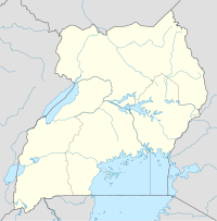
 Moyo
Moyo
Placement on map is approximateSummary Airport type Public Owner Moyo Town Council Serves Moyo, Uganda Location Moyo,  Uganda
Elevation AMSL 3,100 ft / 940 m Coordinates 03°38′57″N 31°45′54″E / 3.64917°N 31.765°E Runways Direction Length Surface ft m 02/20 4,260 1,300 Unpaved Moyo Airport (IATA: OYG, ICAO: n/a) is an airport in Uganda. It is one of the forty-six (46) airports in the country.[1]
Contents
Location
Moyo Airport is located in the town of Moyo, Moyo District, West Nile sub-region, in Northern Uganda, close to the International border with South Sudan. Its location is approximately 406 kilometres (252 mi), by air, north of Entebbe International Airport, the country’s largest civilian and military airport.[2] The geographic coordinates of this airport are 3°38′56″N 31°45′52″E / 3.64889°N 31.76444°ECoordinates: 3°38′56″N 31°45′52″E / 3.64889°N 31.76444°E.
Overview
Moyo Airport is a small civilian airport that serves the town of Moyo. As of August 2011, the airport is not yet under the administration of the Uganda Civil Aviation Authority.[3] Moyo Airport is situated 3,100 feet (940 m) above sea level.[4] The airport has a single unpaved runway which measures 4,260 feet (1,300 m) long.[5]
Scheduled services
Airlines Destinations Eagle Air Uganda Entebbe External links
Photos
See also
References
 Moyo District
Capital: Moyo Towns and
villagesGeography Albert NileEconomy Stanbic Bank · Gwere-Luzira Power StationNotable
landmarksMoyo Hospital · Moyo AirportCategories:- Airports in Uganda
- Moyo District
- Northern Region, Uganda

Wikimedia Foundation. 2010.