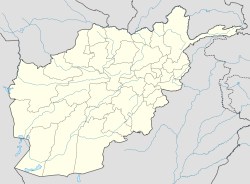
Dishu — Admin ASC 2 Code Orig. name Dīshū Country and Admin Code AF.10.7053017 AF … World countries Adminstrative division ASC I-II
Dishu District — Dishu is a district in the south of Helmand Province, Afghanistan, bordering Pakistan. Its population, which is 58% Pashtun and 42% Baloch, was estimated at 20,600 in 2002. The district centre is the village of Dishu; most of the settlements in… … Wikipedia
`Alaqahdari Dishu — Original name in latin ‘Alqahdr Dsh Name in other language Dishu, Dsh Alaqadari Dehe Su, Alaqahdari Deh e Shu, Alaqahdari Dishu, Alaqehdari Deh e Shu, ‘Alqahdr Deh e Sh ‘Alqahdr Dsh ‘Alqa Dehe Su, ‘Alqehdr Deh e Sh State code AF Continent/City… … Cities with a population over 1000 database
List of Afghanistan-related topics — This is a list of Afghanistan related articles. See also the .Afghanistan* Afghanistan * SalajeetBuildings and structures in Afghanistan* Buddhas of Bamyan * Chakhil i Ghoundi Stupa * Darul Aman Palace * Kajakai Dam * Tajbeg PalaceArchaeological… … Wikipedia
Helmand Province — Geobox|Province country = Afghanistan country name = Helmand native name = هلمند map caption = Map of Afghanistan with Helmand highlighted capital = Lashkar Gah capital lat d = 31.0 capital long d = 64.0 population as of = population = 745,000… … Wikipedia
Nangarhar Province — Coordinates: 34°15′N 70°30′E / 34.25°N 70.50°E / 34.25; 70.50 … Wikipedia
Nimruz Province — Coordinates: 31°00′N 62°30′E / 31.0°N 62.5°E / 31.0; 62.5 … Wikipedia
Nuristan Province — This page is about the province in Afghanistan. Nuristan is also a proposed name of Khyber Pakhtunkhwa Province of Pakistan. Coordinates: 35°15′N 70°45′E / 35.25°N 70.75°E … Wikipedia
Orūzgān Province — Coordinates: 32°48′N 66°00′E / 32.8°N 66.0°E / 32.8; 66.0 … Wikipedia
Sar-e Pol Province — Coordinates: 35°36′N 66°18′E / 35.6°N 66.3°E / 35.6; 66.3 … Wikipedia
 Afghanistan
