Flagg Township Public Library
- Flagg Township Public Library
Infobox nrhp
name = Flagg Township Public Library
nrhp_type =
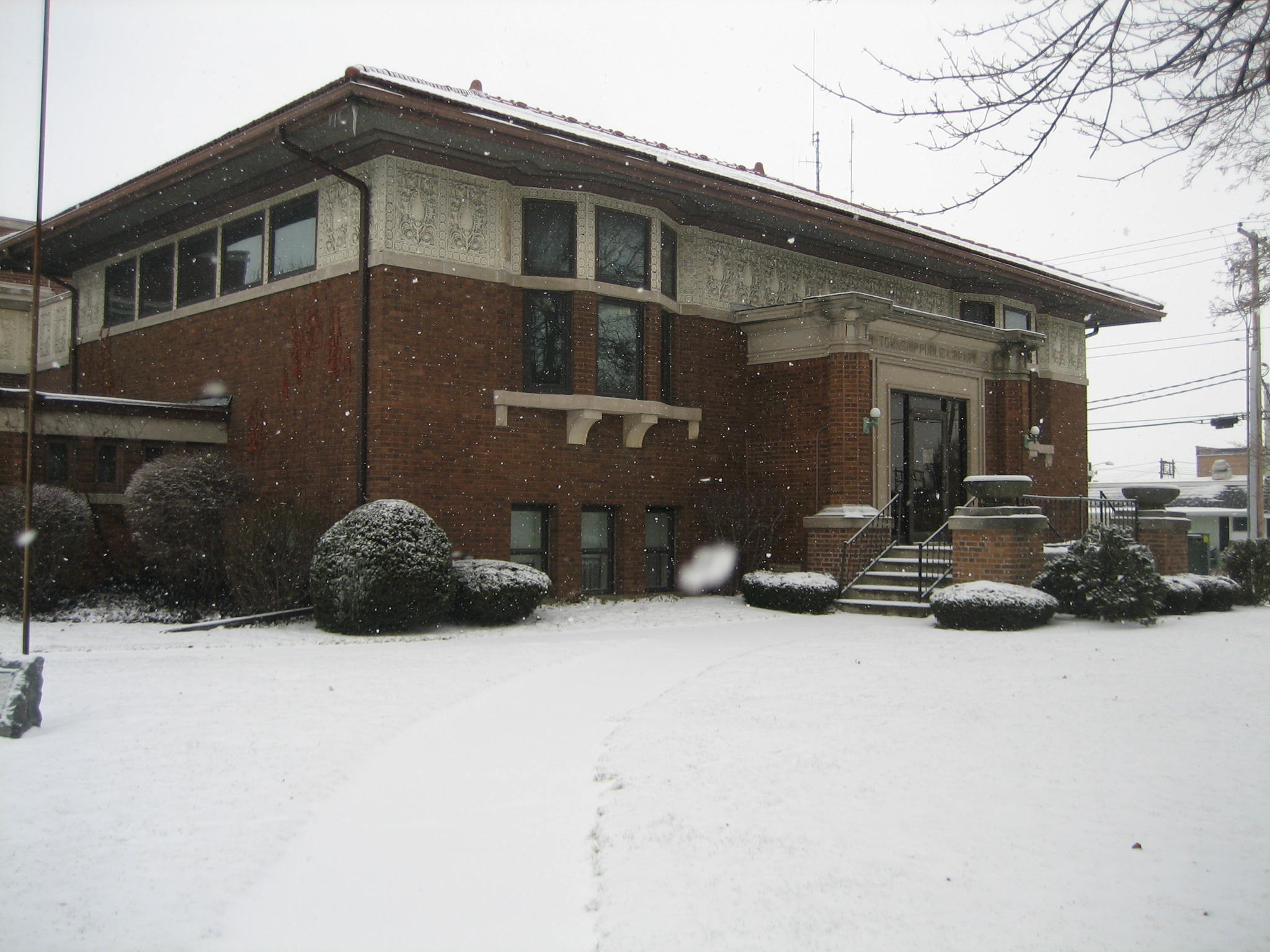
caption = The Rochelle Flagg Township Public Library.
location = Rochelle, Ogle County, Illinois, USA
nearest_city =
lat_degrees = 41
lat_minutes = 55
lat_seconds = 24
lat_direction = N
long_degrees = 89
long_minutes = 3
long_seconds = 56
long_direction = W
area =
built = 1912 [Date engraving on building, on site, ( [http://commons.wikimedia.org/wiki/
 ] )]
] )]
architect =
architecture = Prairie[ [http://gis.hpa.state.il.us/hargis/Main Property Information Report] , Flagg Township Library, HAARGIS Database, Illinois Historical Preservation Agency. Retrieved 2 February 2007.] ]
added = October 25, 1973 [ [http://www.nr.nps.gov/nrloc1.htm NRIS Database] , National Register of Historic Places, retrieved January 21, 2007.]
visitation_num =
visitation_year =
refnum = 73000713
mpsub =
governing_body = Flagg Township Public Library is found in the Ogle County, Illinois city of Rochelle. It is a Carnegie library, designed in 1912 by Madison, Wisconsin architects Claude & Starck. The library, just blocks from the city's downtown district, is one of three Rochelle sites listed on the National Register of Historic Places. The other two are the William H. Holcomb House, on 7th Street and the City and Town Hall, just down the block from the library. The library joined the National Register on October 25, 1973, the same day as the Holcomb House.
Notes
Wikimedia Foundation.
2010.
Look at other dictionaries:
City and Town Hall — Infobox nrhp name = City and Town Hall nrhp type = caption = location = Junction of Fourth Avenue and Sixth Street, Rochelle, Ogle County, Illinois, USA nearest city = lat degrees = 41 lat minutes = 55 lat seconds = 24 lat direction = N long… … Wikipedia
City and Town Hall (Rochelle, Illinois) — This article is about a building in Rochelle, Illinois. For city halls and town halls in general, see City and town halls. City and Town Hall U.S. National Register of Historic Places … Wikipedia
National Register of Historic Places listings in Ogle County, Illinois — See also: List of Registered Historic Places in Illinois Contents: List of Registered Historic Places in Ogle County, Illinois, USA: Map of all coordinates from Google Map of all coord … Wikipedia
Illinois Carnegie Libraries Multiple Property Submission — Infobox nrhp name = Illinois Carnegie Libraries MPS nrhp type = caption =Buffalo Township Public Library in Polo, Illinois. location = Illinois, USA nearest city = lat degrees = lat minutes = lat seconds = lat direction = long degrees = long… … Wikipedia
William H. Holcomb House — Infobox nrhp name = William H. Holcomb House nrhp type = caption = The Italianate William H. Holcomb House in Rochelle, Illinois. location = Rochelle, Ogle County, Illinois, USA nearest city = lat degrees = 41 lat minutes = 55 lat seconds = 24… … Wikipedia
Massachusetts — This article is about the U.S. state. For other uses, see Massachusetts (disambiguation). Commonwealth of Massachusetts … Wikipedia
Oregon, Illinois — Coordinates: 42°00′52.59″N 89°19′57.13″W / 42.0146083°N 89.3325361°W / 42.0146083; 89.3325361 … Wikipedia
Mount Morris, Illinois — Coordinates: 42°02′51″N 89°26′02″W / 42.0475°N 89.43389°W / 42.0475; 89.43389 … Wikipedia
Plainfield, Illinois — Geobox|Settlement name = Plainfield native name = other name = category = Village etymology = official name = motto = nickname = image caption = symbol = country = United States state = Illinois region = Will, Kendall region type = County… … Wikipedia
Victory Boulevard (Staten Island) — Victory Boulevard Map of Staten Island with Victory Boulevard highlighted in red Route information Length: 8.06 mi … Wikipedia