Chapada do Araripe

Chapada do Araripe
Chapada do Araripe

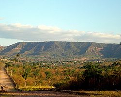
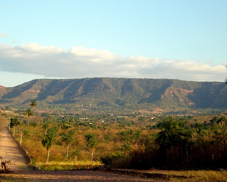
The Chapada do Araripe, also known as the Serra do Araripe, is a chapada (plateau) in northeastern Brazil. The chapada forms the boundary of Ceará and Pernambuco states, and forms the watershed between the Jaguaribe River of Ceará, which flows northward into the Atlantic, and the much larger basin of the São Francisco River of Pernambuco and neighboring states, which drains eastward into the Atlantic. The Santana Formation, which is rich with fossils from the early Cretaceous, lies at the base of the chapada. The Araripe Manakin (Antilophia bokermanni), a bird only described in 1998, is endemic to Chapada do Araripe.


Wikimedia Foundation. 2010.

Игры ⚽ Нужно сделать НИР?

Look at other dictionaries:

  • Chapada do Araripe — Sp Araripės plýnaukštė Ap Chapada do Araripe L Brazilijoje (Searos v ja) …   Pasaulio vietovardžiai. Internetinė duomenų bazė

  • Microregion de la Chapada do Araripe — Microrégion de la Chapada do Araripe La microrégion de la Chapada do Araripe est l une des cinq microrégions qui subdivisent le sud de l État du Ceará au Brésil. Elle comporte 5 municipalités qui regroupaient 95 047 habitants en 2006 pour… …   Wikipédia en Français

  • Microrégion De La Chapada Do Araripe — La microrégion de la Chapada do Araripe est l une des cinq microrégions qui subdivisent le sud de l État du Ceará au Brésil. Elle comporte 5 municipalités qui regroupaient 95 047 habitants en 2006 pour une superficie totale de… …   Wikipédia en Français

  • Microrégion de la chapada do araripe — La microrégion de la Chapada do Araripe est l une des cinq microrégions qui subdivisent le sud de l État du Ceará au Brésil. Elle comporte 5 municipalités qui regroupaient 95 047 habitants en 2006 pour une superficie totale de… …   Wikipédia en Français

  • Microrégion de la Chapada do Araripe — La microrégion de la Chapada do Araripe est l une des cinq microrégions qui subdivisent le sud de l État du Ceará au Brésil. Elle comporte 5 municipalités qui regroupaient 95 047 habitants en 2006 pour une superficie totale de… …   Wikipédia en Français

  • Microrregión de la Chapada do Araripe — Mapa Entidad Microrregión  • …   Wikipedia Español

  • Araripe Manakin — Taxobox name = Araripe Manakin status = CR | status system = IUCN3.1 regnum = Animalia phylum = Chordata classis = Aves ordo = Passeriformes familia = Pipridae genus = Antilophia species = A. bokermanni binomial = Antilophia bokermanni binomial… …   Wikipedia

  • Chapada — Para el municipio del estado de Rio Grande do Sul, véase Chapada (Rio Grande do Sul)]. Chapada Diamantina, en el estado brasileño de Bahía. Una chapada es una formación rocosa elevada (superior a los 600 metros de altura), que tiene una porción… …   Wikipedia Español

  • Chapada (géologie) — 28°03′18″S 53°04′04″O / 28.055, 53.06778 …   Wikipédia en Français

  • Chapada — A chapada is a plateau found in the Brazilian Highlands. The chapadas, which are usually described as mountain ranges, are capped by horizontal strata of sandstone and show the original surface, which has been worn away by the rivers, leaving… …   Wikipedia

Share the article and excerpts

Direct link
Do a right-click on the link above
and select “Copy Link”