Bushland Beach, Queensland
- Bushland Beach, Queensland
Infobox Australian Place | type = suburb
name = Bushland Beach
city = Townsville
state = Qld
caption =
lga =
postcode = 4818
est =
pop = 2,619
area =
propval =
stategov = Thuringowa
fedgov = Herbert
near-nw = Halifax Bay
near-n = Halifax Bay
near-ne =
near-w = Beach Holm
near-e = Townsville
near-sw = Jensen
near-s = Mt Low
near-se = Thuringowa Central
dist1 =
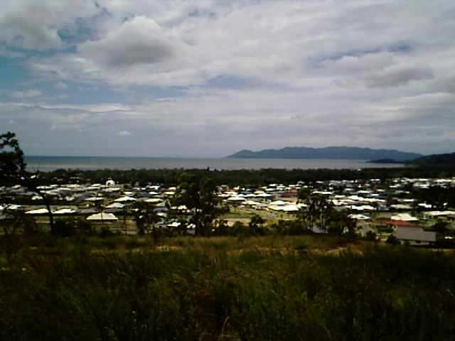
location1= Bushland Beach is part of the Northern Beaches area of Townsville,Queensland, alongside the Bruce Highway. This beachside suburb is one of the fastest-growing suburbs in Townsville.
Bushland Beach is also home to the 4 star Ocean Palms Resort. Fishing, swimming and water activities are popular and at low tide you can walk to an old wooden shipwreck. The beach is well serviced by the Resort, playgrounds, barbecue facilities and a boat ramp.The Suburb's name is derived by the fact that it is located in dense bushland that greets the seashore.
Transport
The Route 33 Bus or Bushland Beach Bus as it is better known, services the area every day of the year, except for weekends and public holidays.
Wikimedia Foundation.
2010.
Look at other dictionaries:
Saunders Beach, Queensland — Infobox Australian Place | type = suburb name = Saunders Beach city = Townsville state = Qld caption = lga = postcode = 4818 est = pop = 407 area = propval = stategov = Thuringowa fedgov = Herbert near nw = Toolakea near n = Halifax Bay near ne … Wikipedia
Deeragun, Queensland — Deeragun Townsville, Queensland Population: 2,626 Postcode: 4818 LGA: City of Townsville … Wikipedia
Townsville, Queensland — Infobox Australian Place | type = city name = Townsville state = qld caption = The CBD from Palmer Street, South Townsville Castle Hill in the background pop = 143,328Census 2006 AUS|id=3057|name=Townsville (QLD) (Statistical… … Wikipedia
Nelly Bay, Queensland — Nelly Bay Magnetic Island, Queensland Rocky Bay (foreground) and Nelly Bay foreshore, showing Magnetic Harbour in the distance … Wikipedia
Mount Stuart, Queensland — This article is about the mountain overlooking Townsville. For the one in Central Australia, see Central Mount Stuart. Mount Stuart Mount Stuart, overlooking Townsville, Queensland … Wikipedia
Oonoonba, Queensland — Oonoonba Townsville, Queensland Population: 1,174 Postcode: 4811 LGA: City of Townsville … Wikipedia
Mundingburra, Queensland — Mundingburra redirects here. For the Queensland electoral division, see Electoral district of Mundingburra. Mundingburra Townsville, Queensland Postcode: 4812 LGA: City of To … Wikipedia
Cluden, Queensland — Cluden Townsville, Queensland Postcode: 4811 LGA: City of Townsville State District … Wikipedia
Mutarnee, Queensland — Mutarnee Townsville, Queensland … Wikipedia
Douglas, Queensland — Douglas Townsville, Queensland Flag at roundabout on the Bruce Highway at the entrance to Douglas … Wikipedia