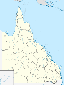
- Mutarnee, Queensland
-
Mutarnee
Townsville, QueenslandPostcode: 4816 Coordinates: 18°57′6″S 146°18′36″E / 18.95167°S 146.31°ECoordinates: 18°57′6″S 146°18′36″E / 18.95167°S 146.31°E State District: Hinchinbrook Federal Division: Herbert Suburbs around Mutarnee: Coolbie Forrest Beach Palm Island Paluma Range National Park Mutarnee Balgal Beach Paluma Crystal Creek Rollingstone Mutarnee is a small rural/residential township approximately 67 kilometres north-east of Townsville, Queensland, Australia and 44 kilometres south-east of Ingham. It is situated on the banks of Crystal Creek and is within close proximity to the rainforest village of Paluma
Facilities at Mutarnee include a state primary school,[1] a recreational waterhole, and a camping area at nearby Crystal Creek. The popular cafe and ice-creamery, Frosty Mango, is also located in Mutarnee, north of the Crystal Creek bridge.[2]
Suburbs of Townsville | North Queensland | Queensland Urban Aitkenvale · Annandale · Belgian Gardens · Bohle · Castle Hill · Cluden · Condon · Cranbrook · Currajong · Douglas · Garbutt · Gulliver · Gumlow · Heatley · Hermit Park · Hyde Park · Idalia · James Cook University · Kelso · Kirwan · Lavarack Army Barracks · Mount Louisa · Mount St John · Mount Stuart · Mundingburra · Murray · Mysterton · North Ward · Oonoonba · Pallarenda · Pimlico · Railway Estate · Rasmussen · Rosslea · Rowes Bay · Shaw · South Townsville · Thuringowa Central · Townsville City · Vincent · West End · Wulguru
Rural Alice River · Alligator Creek · Balgal Beach · Black River · Blue Hills · Bluewater Park · Bohle Plains · Brookhill · Calcium · Cape Cleveland · Cleament · Crimea · Crystal Creek · Cungulla · Hervey Range · Hidden Valley · Julago · Lynam · Majors Creek · Mount Elliot · Mutarnee · Nome · Oak Valley · Orpheus Island · Palm Island · Partington · Pinnacles · Rangewood · Reid River · Rollingstone · Roseneath · Rupertswood · Stuart · Toomulla · Toonpan · Woodstock
Northern Beaches Beach Holm · Bluewater · Burdell · Bushland Beach · Deeragun · Jensen · Mount Low · Purono Park · Saunders Beach · Toolakea · Yabulu
Magnetic Island Arcadia · Cockle Bay · Horseshoe Bay · Magnetic Island · Nelly Bay · Picnic Bay
References
- ^ Mutarnee State School, accessed 1 November 2010.
- ^ Frosty Mango, accessed 1 November 2010.
Categories:- Suburbs of Townsville
Wikimedia Foundation. 2010.

