Manhan River

Manhan River
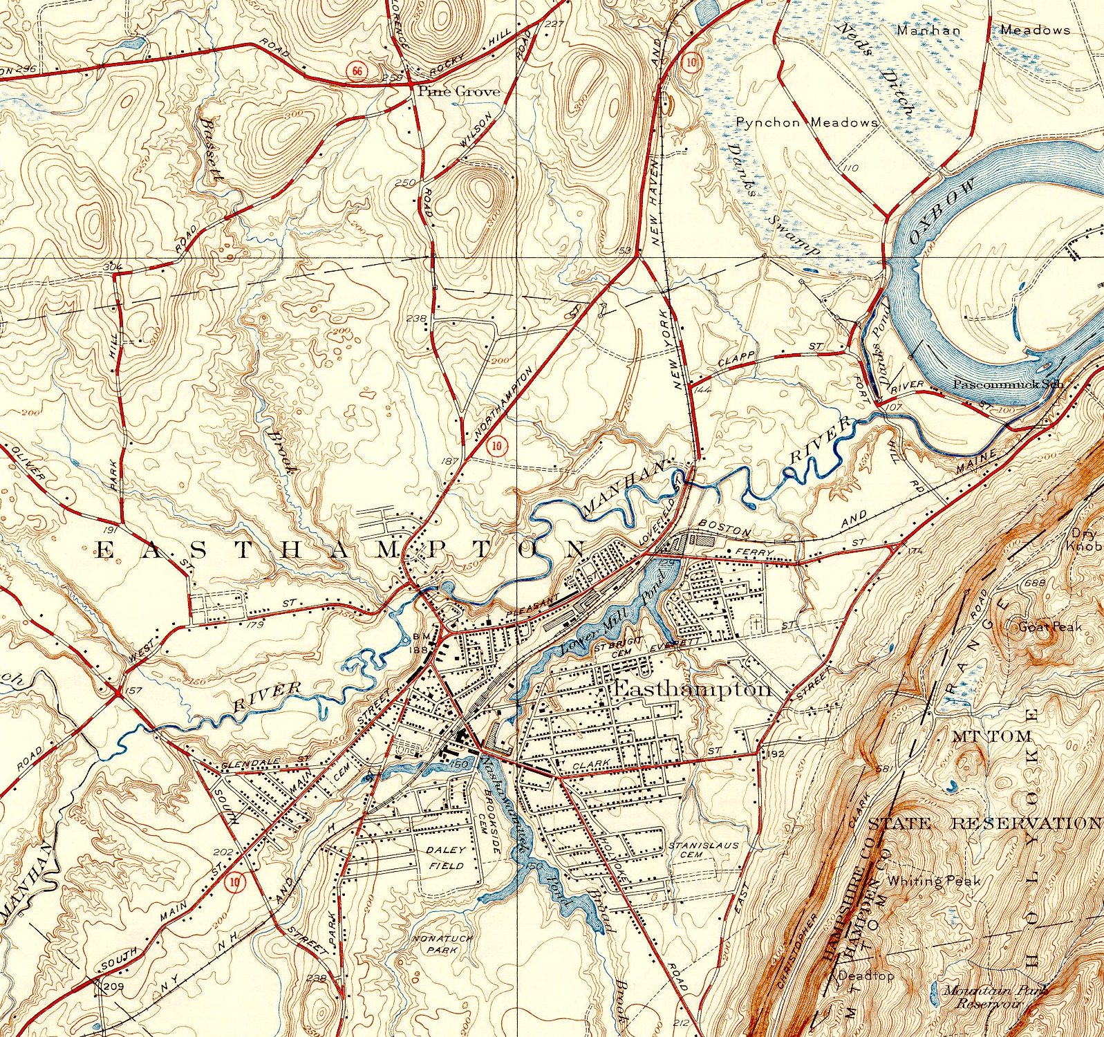
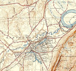
Manhan River, lower stretch

The Manhan River is a 27.6-mile-long (44.4 km)[1] river in western Massachusetts. It is a tributary of the Connecticut River.

The river begins near the boundary between the towns of Huntington and Westhampton, Massachusetts, and flows southeast to White Reservoir and then Tighe Carmody Reservoir in Southampton. The river continues southeast, then turns northeasterly and flows through the middle of Easthampton to its confluence with the Connecticut River at a westward curve called The Oxbow. The river provides excellent views of nearby Mount Tom.

Europeans first settled the area in 1664 and later established saw mills on the river. In 1847 large mills began with the Williston-Knight Button Company; a number of other factories sprang up nearby in the next few years. Small lead mines also were established near the river. Of particular note is the Manhan River mine near Loudville, noted for its pyromorphite and wulfenite. A former railroad has been converted to the Manhan Rail Trail, which now provides a scenic pathway along the river.

References

  1. ^ U.S. Geological Survey. National Hydrography Dataset high-resolution flowline data. The National Map, accessed April 1, 2011


Wikimedia Foundation. 2010.

Игры ⚽ Поможем сделать НИР

Look at other dictionaries:

  • Manhan Rail Trail — The Manhan Rail Trail is a rails to trails paved recreational trail and non motorized commuter route located in the lower Connecticut River Valley of Massachusetts in the town of Easthampton. The 4.2 mi (6.8 km) long trail, completed in …   Wikipedia

  • Connecticut River — Coordinates: 41°16′20″N 72°20′03″W / 41.27222°N 72.33417°W / 41.27222; 72.33417 …   Wikipedia

  • Connecticut River — Einzugsgebiet des Flusses Daten …   Deutsch Wikipedia

  • List of rivers of Massachusetts — List of rivers in Massachusetts (U.S. state). All Massachusetts rivers flow to the Atlantic Ocean. The list is arranged by drainage basin from north to south, with respective tributaries indented under each larger stream s name, arranged… …   Wikipedia

  • Easthampton, Massachusetts — Infobox Settlement official name = Easthampton, Massachusetts nickname = motto = imagesize = image caption = image mapsize = 250px map caption = Location in Hampshire County in Massachusetts mapsize1 = map caption1 = subdivision type = Country… …   Wikipedia

  • Liste von Flüssen in den Vereinigten Staaten — Die folgende Liste zeigt eine Vielzahl von Flüssen in den Vereinigten Staaten und deren Territorien auf Inhaltsverzeichnis A B C D E F G H I J K L M N O P Q R S T …   Deutsch Wikipedia

  • List of place names in New England of aboriginal origin — This is a List of place names in New England of aboriginal origin. New England is in the northeastern part of the United States, and comprises six states: Connecticut, Maine, Massachusetts, New Hampshire, Rhode Island, and Vermont. Listed are… …   Wikipedia

  • Río Connecticut — Saltar a navegación, búsqueda Río Connecticut Arriba: Cuenca del río C …   Wikipedia Español

  • Mount Tom Range — Metacomet Ridge Range …   Wikipedia

  • Alder Meadow Brook — ist der Name mehrerer Flüsse in den Vereinigten Staaten: Alder Meadow Brook (Manhan River), ein Fluss im US Bundesstaat Massachusetts (Hampshire County) Alder Meadow Brook (Westfield Brook), ein Fluss im US Bundesstaat Massachusetts (Berkshire… …   Deutsch Wikipedia

Share the article and excerpts

Direct link
Do a right-click on the link above
and select “Copy Link”