- Fayzabad Airport
-
Fayzabad Airport IATA: FBD – ICAO: OAFZ Summary Location Fayzabad, Afghanistan Elevation AMSL 3,672 ft / 1,171 m Coordinates 37°07′19″N 70°31′07″E / 37.12194°N 70.51861°ECoordinates: 37°07′19″N 70°31′07″E / 37.12194°N 70.51861°E 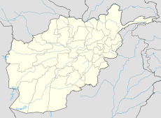
 Faizabad AptLocation of Faizabad Airport, Afghanistan
See also: Faizabad (disambiguation)
Fayzabad Airport (or Faizabad Airport) (IATA: FBD, ICAO: OAFZ) is and airport 3.5 miles northwest of the town of Faizabad. Built during the Soviet Occupation, Fayzabad Airport is somewhat unique in the world, notable for the runway being constructed of Pierced Steel Planking (PSP or Marsden Matting) along it's full width and length. A new runway made of more common materials is being constructed parallel to the steel runway as a replacement for the original unique strip.
See also
External links
Categories:- Airports in Afghanistan
- Afghan building and structure stubs
- Asian airport stubs

Wikimedia Foundation. 2010.