- Isla de Alborán
-
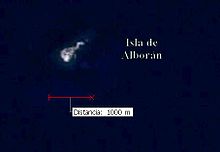
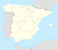
The Isla de Alborán is a small islet in the Alborán Sea, part of the western Mediterranean, about 50 km north of the Moroccan coast and 90 km south of the province of Almería, Spain. A Spanish possession since 1540, it was taken from the Tunisian pirate Al Borani in the Battle of Alborán. It is home today to a small Spanish Navy garrison and an automated lighthouse. Some 100 m off the northeastern end of the island is the small Isla de las Nubes (literally, island of the clouds).
While Morocco claims the Spanish-held plazas de soberanía enclaves and islands on or near the Moroccan coast as part of Greater Morocco, it has never filed a formal claim to Alborán.
During antiquity, Alboran was known as "Erroris" and as "Albusama".
Today, the island administratively belongs to the city council (Spanish: ayuntamiento) of Almería and is part of the Almería Pescadería (fish market) district.
General data
- Position: 35°56′42″N 03°02′12″W / 35.945°N 3.03667°WCoordinates: 35°56′42″N 03°02′12″W / 35.945°N 3.03667°W
- Area: About 71,200 m² (or 17.6 acres). Close to the island there is another called Cloud Islet.
- Altitude: The island is a flat platform about 15 m above sea level.
- Curiosities: Owing to its strategic value, in about 1960 a few supposed fishing vessels from the Soviet Union tried to install a stable base on the island. For this reason the Spanish army established a settlement on Alborán for its control and protection.
External links
See also
Categories:- Almería
- Islands of Africa
- Islands of Spain
- Mediterranean islands
- Volcanoes of Africa
- Volcanoes of Spain
- Pre-Holocene volcanoes
- Almería province geography stubs
Wikimedia Foundation. 2010.


