- Oud-Vossemeer
-
Oud-Vossemeer — Village — 
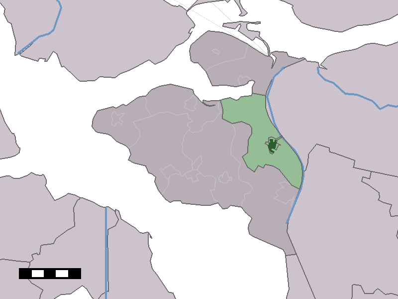
Coat of arms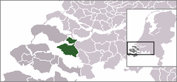 The town centre (dark green) and the statistical district (light green) of Oud-Vossemeer in the municipality of Tholen.
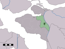
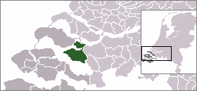
Coordinates: 51°34′14″N 4°11′59″E / 51.57056°N 4.19972°ECoordinates: 51°34′14″N 4°11′59″E / 51.57056°N 4.19972°E Country Netherlands Province Zeeland Municipality Tholen Area – Total 13.64 km2 (5.3 sq mi) Population (1 January 2010) – Total 2,767 – Density 202.9/km2 (525.4/sq mi) Time zone CET (UTC+1) – Summer (DST) CEST (UTC+2) Postal code Oud-Vossemeer is a village on the island of Tholen in the Dutch province of Zeeland. It is a part of the municipality of Tholen, and lies about 11 km northwest of Bergen op Zoom, close to the Eendracht, part of the Scheldt-Rhine Canal.
The ancestors of the American presidential family Roosevelt may have lived in Oud-Vossemeer. A monument honoring the Four Freedoms (formulated by Franklin Delano Roosevelt) was placed in the center of the village.
It includes the previous municipality of Vrijberge
Oud-Vossemeer was a separate municipality until 1971, when it was merged with Tholen.[1]
In 2001, the town of Oud-Vossemeer had 1948 inhabitants. The built-up area of the town was 0.45 km², and contained 779 residences.[2] The statistical area "Oud-Vossemeer", which also can include the surrounding countryside, has a population of around 2720.[3]
References
- ^ Ad van der Meer and Onno Boonstra, Repertorium van Nederlandse gemeenten, KNAW, 2006.
- ^ Statistics Netherlands (CBS), Bevolkingskernen in Nederland 2001 [1]. (Statistics are for the continuous built-up area).
- ^ Statistics Netherlands (CBS), Statline: Kerncijfers wijken en buurten 2003-2005 [2]. As of 1 January 2005.
External links
- J. Kuyper, Gemeente Atlas van Nederland, 1865-1870, "Oud-Vossemeer". Map of the former municipality, around 1868.
- Site about Oud Vossemeer, Roosevelt and Four Freedoms Award
Categories:- Populated places in Zeeland
- Former municipalities of Zeeland
- Zeeland geography stubs
Wikimedia Foundation. 2010.