- Mount Papandayan
-
Mount Papandayan 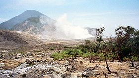
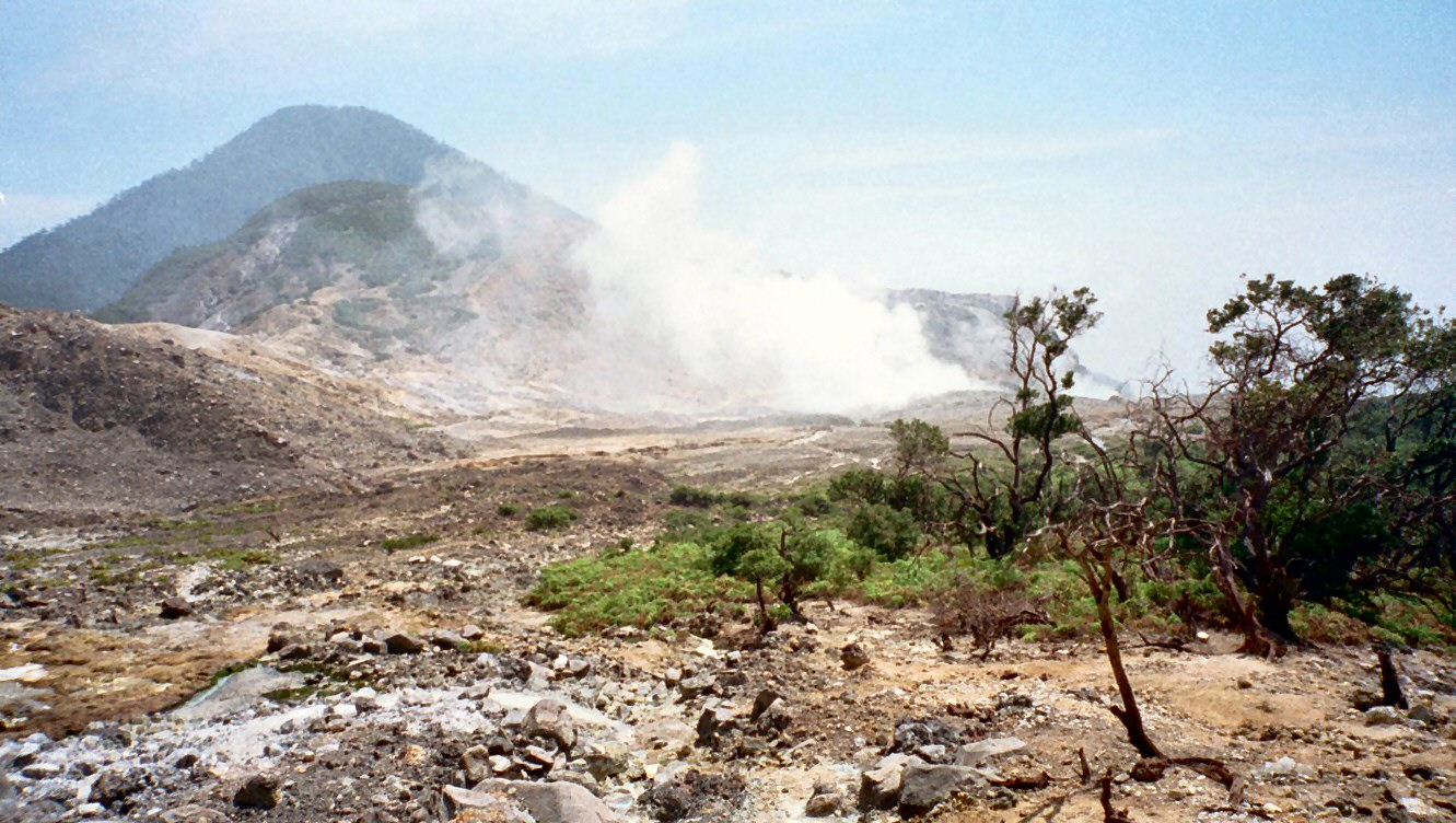
Elevation 2,665 m (8,743 ft) [1] Listing Ribu Location Location Java, Indonesia Coordinates 7°19′S 107°44′E / 7.32°S 107.73°E Geology Type Stratovolcanoes Last eruption 2002 Mount Papandayan is a complex stratovolcano, located in Garut Regency, to the southeast of the city of Bandung in West Java, Indonesia. It is about 15 km to the southwest of the town of Garut. At the summit, there are four large craters which contain active fumarole fields. An eruption in 1772 caused the northeast flank to collapse producing a catastrophic debris avalanche that destroyed 40 villages and killed nearly 3,000 people. The eruption truncated the volcano into a broad shape with two peaks and a flat area 1.1 km wide with Alun-Alun crater in the middle, making the mountain look like a twin volcano. One of the peaks is called Papandayan and the other Mount Puntang.[1]
Since 1772, only small phreatic eruptions were recorded before an explosive eruption that began in November 2002. More recently, the volcano has been quite active. On 14 August 2011 the volcano's warning status was lifted from Level II, "Vigilant" (Indonesian: Waspada) to Level III, "Alert" (Indonesian: Siaga) following the emission of dangerous hydrogen sulfide and carbon monoxide gases. People, including tourists, were urged to remain at least 2 kilometers (1.2 mi) from the yellow craters on the 2,665-meter (8,743-foot) Mount Papandayan.[2] On Friday 2 September 2011, the Indonesian Volcanology and Geophysical Disaster Mitigation Center reported that numerous shallow volcanic earthquakes had been recorded along with other indications of volcanic activity. A spokesperson for the Indonesian National Disaster Management Agency noted that if Mt Papandayan erupted, over 170,000 people living in five nearby subdistricts (kecamatan) and in 20 villages could be affected.[3] Of the people likely to be affected, it was expected that perhaps as many as 11,500 people might need to be evacuated.
Contents
Volcanism
Mount Papandayan is a large composite volcano. It is constructed of alternating layers of lava and ash, and other fragmental volcanic rock debris formed by explosive eruptions over the past several hundred years. A large horseshoe-shape crater extended to the northeast resulting in an avalanche deposit consisted of intermixed volcanic debris and alternated rocks, with steep-sided crater walls. Numerous small vents within the crater, known as Kawah Mas, Kawah Baru, Kawah Nangklak, Kawah Manuk and many other with solfataras emitting smoke and hot fumes from its inner sides.[4]
Tourism
The Mount Papandayan area is a popular tourist site.[5] Tourists can walk across the crater and view phenomena such as bubbling mud pools, steam vents and sulfur deposits. The bubbling yellow crater (Kawah Papandayan or "Papandayan Crater") is a popular sight.[4] There are various other volcanic craters in the area to the south of Bandung as well. Another volcanic crater in the same region with easy access is Kawah Putih in the nearby Bandung District to the west of Mt Papandayan.
Above the crater is an elfin forest and several meadows with Javanese edelweiss.[4]
See also
References
- ^ a b "Papandayan". Global Volcanism Program. Smithsonian Institution. http://www.volcano.si.edu/world/volcano.cfm?vnum=0603-10=. Retrieved 2006-12-21.
- ^ "Indonesia Warns Tourists away from Smoking Volcano". August 14, 2011. http://english.kompas.com/read/2011/08/14/02280569/Indonesia.Warns.Tourists.away.from.Smoking.Volcano.
- ^ Adianto P. Simamora, 'Increased activity at 22 volcanoes, alert raised', The Jakarta Post, 3 September 2011. The five kecamatan subdistricts listed by the National Disaster Management Agency were Cisurupan, Pamulihan, Bayongbong, Pakenjeng, and Sukaresmi.
- ^ a b c Mountain Tourism: Mount Papandayan, "The Beauty of Elfin Woodland". Jakarta: Ministry of Culture and Tourism. 2009.
- ^ Useful details are at the Gunung Bagging website for Papandayan. Information about Gunung Bagging activities is at Imogen Badgery-Parker, 'Climb ev'ry mountain', The Jakarta Post, 6 December 2009.
Categories:- Stratovolcanoes
- Mountains of Indonesia
- Volcanoes of Java
- West Java
- Active volcanoes of Indonesia
Wikimedia Foundation. 2010.