- Mount Patuha
-
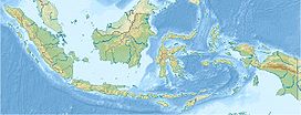
Mount Patuha Java, Indonesia Elevation 2,434 m (7,986 ft) [1] Listing Ribu Location Coordinates 07°09′37″S 107°24′00″E / 7.16028°S 107.4°ECoordinates: 07°09′37″S 107°24′00″E / 7.16028°S 107.4°E[1] Geology Type Stratovolcano Mount Patuha is a twin stratovolcano about 50 km to the southwest of Bandung in West Java, Indonesia. It is located in the Bandung District of West Java. It is one of numerous volcanoes in this area; others in the region include Mt Malabar, Mt Wayang, and Mount Papandayan (placed on a warning alert in August 2011).
The summit of Mt Patuha contains two volcanic craters 600 m apart. The northwest crater is dry but the southeast one has a greenish-white crater lake called Kawah Putih (or white crater). There was formerly a sulfur mine at Kawah Putih although production has now ceased. No detailed history of eruptions is known for Mount Patuha.[1]
Kawah Putih
This crater contains a striking lake.[2] The area was opened in 1987 as a tourist spot and attracts a considerable number of visitors. There is a good 5-kilometer access road from the main road (which, in turn, is the main road south from Bandung through the town of Ciwidey). The surface of the lake changes colour from blueish green to whitish green depending on the concentration of sulphur and the weather. At full moon, fluorescent green light appears from the (lake) crater. Pre-wedding pictures are frequently taken here due to the magnificent scenery.[3]
See also
References
- ^ a b c "Patuha". Global Volcanism Program, Smithsonian Institution. http://www.volcano.si.edu/world/volcano.cfm?vnum=0603-07=. Retrieved 2006-12-20.
- ^ Simon Marcus Gower, 'Heading for the hills around Bandung', The Jakarta Post, 29 February 2008.
- ^ http://indonesianview.com/tag/kawah-putih/
Categories:- Stratovolcanoes
- Mountains of Indonesia
- Volcanoes of Java
- Crater lakes
- West Java
- Java geography stubs
Wikimedia Foundation. 2010.

