- Sequatchie River
Infobox River
river_name = Sequatchie River
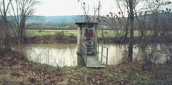
caption = Astream gage along the Sequatchie River nearWhitwell, Tennessee
origin = Devilstep Hollow Cave inCumberland County, Tennessee
mouth =Tennessee River inMarion County, Tennessee
basin_countries =USA
length =
elevation = 1080 ft (329 m)
mouth_elevation = 595 ft (181 m)
discharge =
watershed =The Sequatchie River drains the
Sequatchie Valley , a large valley in theCumberland Plateau inMiddle Tennessee .Hydrography
The Sequatchie River's source is a massive spring which flows out of Devilstep Hollow Cave, a large
limestone cavern . It receives the drainage ofGrassy Cove , a pastoral limestone region several miles to the north from which the drainage has no surface outlet, through a spectacular series of underground passages. This cave is located in the southeastern portion of Cumberland County, and the water flowing from it is augmented by that of other sizeable springs and small streams, at least one of which provided enough flow for an earlytextile industry. The stream crosses into Bledsoe County and is at the floor of a valley that trends generally southwestward and is several miles wide. Natives of the area tend to call the portion of the Cumberland Plateau to the west of the valley the "Cumberland Mountains" or "the Plateau" and that to the east of itWalden Ridge or "Wallings Ridge". The Sequatchie Valley is traversed throughout much its length byU.S. Highway 127 . The first sizeable town on the Sequatchie is Pikeville. State Route 30, which descends Waldens Ridge into the Valley and then climbs theescarpment back onto the plateau, crosses here.Crossing into Sequatchie County, the stream flows into Dunlap. Just north of Dunlap, U.S. 127 turns southeastward, beginning the ascent onto Walden Ridge and eventually down into Chattanooga. A set of railroad tracks runs along the river from here on, testament to heavy underground
coal extraction in years past. For almost the rest of its length the Sequatchie is paralleled by State Route 28. State Route 283 also runs along the base of the Waldens Ridge escarpment for several miles. The river then enters Marion County. The town of Whitwell is just a few miles into Marion County. Below Whitwell at the small community of Sequatchie (also known as Sequachee) the Sequatchie receives the flow of theLittle Sequatchie River . At Jasper, which is slightly west of the river, is a railroad junction. East of town is the crossing ofU.S. Highway 41 by Tennessee 28, and the bridge over the river. Shortly south of theInterstate 24 bridge is the mouth of the Sequatchie into theGuntersville Lake impoundment of theTennessee River .ee also
*
List of Tennessee rivers
Wikimedia Foundation. 2010.