- Sněžka
-
Sněžka Śnieżka, Schneekoppe Mountain  Sněžka from the west.
Countries Czech Republic, Poland Range Krkonoše Elevation 1,602 m (5,256 ft) Coordinates 50°44′10″N 15°44′25″E / 50.73611°N 15.74028°E Easiest access tourist trails,
chairlift from Pec pod Sněžkou
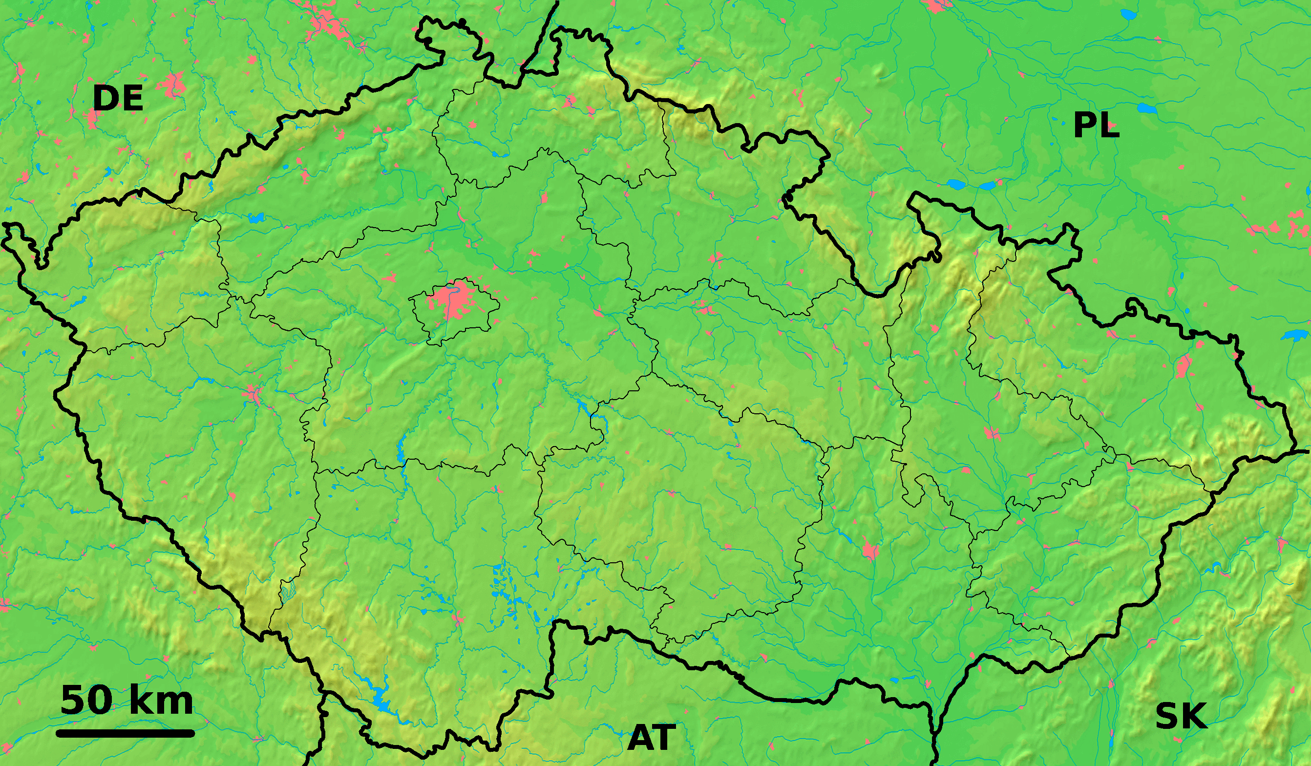
 Location in the Czech Republic
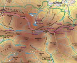 Topographic map
Sněžka or Śnieżka (in Czech and Polish, Schneekoppe in German) is a mountain on the border between the Czech Republic and Poland, the most prominent point of the Silesian Ridge in the Krkonoše mountains. At 1,602 metres (5,256 ft), its summit is the highest point in the Czech Republic, in the Krkonoše and in the entire Sudetes range system.
Contents
History
The first historical account of an ascent to the peak is in 1456, by an unknown Venetian merchant searching for precious stones. The first settlements on the mountain soon appeared, being primarily mining communities, tapping into its deposits of copper, iron and arsenic. The mining shafts, totalling 1.5 kilometres (0.93 mi) in length, remain to this day.
The first recorded German name was Riseberg ("giant mountain", cf. Riesengebirge, "Giant Mountains"), mentioned by Georg Agricola in 1546. Fifteen years later the name Riesenberg appears on Martin Hellwig's map of Silesia. The German name later changed to Riesenkoppe ("giant top") and finally to Schneekoppe ("snow top", "snowy head"[1]).
In Czech, the mountain was initially called Pahrbek Sněžný, and later Sněžovka, with the eventual name Sněžka, meaning "snowy" or "snow covered", adopted in 1823. An older Polish name for the mountain was Góra Olbrzymia, meaning "giant mountain".[2]
The first building on the mountaintop was the chapel of Saint Lawrence (Laurentiuskapelle), built ca. 1665–1681 by the Silesian Schaffgotsch family to mark their dominion, serving also as an inn for a brief period of time. The territory including the mines were the property of the Schaffgotsch family until 1945. The so-called Prussian hut was built on the Silesian (now Polish) side in 1850, followed by the Bohemian hut on the Bohemian (now Czech) side in 1868, both built with the purpose of providing lodging. The Prussian hut was rebuilt twice after fires (1857 and 1862), and the (after 1945) "Polish hut" was finally demolished in 1967. The Bohemian hut fell into disrepair after 1990 and was demolished in 2004.
A wooden weather station was built on the mountaintop ca. 1900, being the only such station in Central Europe remaining intact after World War II. It was demolished in the 1980s.
The mountain today
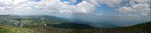 View from the summit of Sněžka-Śnieżka
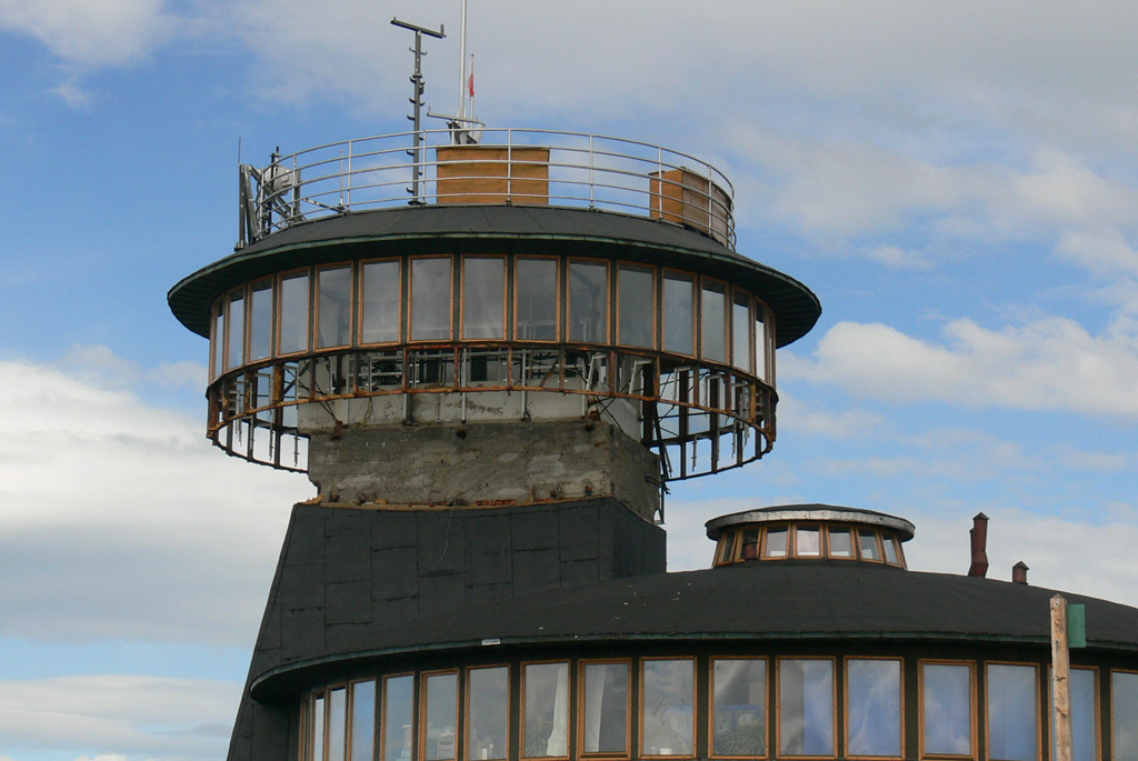
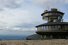 Overview of the observatory. Upper disc's floor broke, and has been dismantled. 10 June 2009
 Damaged upper disc. 10 June 2009
One side of the mountain is in Poland; the other belongs to the Czech Republic. The area is very popular in summer with tourists from Poland, the Czech Republic and Germany who enjoy hiking in the alpine environment one of a kind to this location.
On the Polish side a disc-shaped observatory and restaurant was built in 1974, a weather station and the St. Lawrence chapel. On the Czech side are the remains of the Bohemian hut, a post office, and a chairlift station, connecting the peak with the town of Pec pod Sněžkou at the base of the mountain.
Although the mountain is the highest natural peak of Czech Republic, the actual highest point is the top of the television transmitter on Praděd, reaching 1,652 metres (1,491+162 m). If the Polish observatory is taken into account, Sněžka peaks at 1,620 metres.
In 2004 a new post office and observation platform replaced an old post office and the remains of the Bohemian hut, which was closed since 1980s.
In early 2009 the Polish observatory suffered serious damage to the upper disc as a result of extreme weather and structural failure. Fast response from Technical University of Wrocław saved two remaining disc from taking any further damage. The restaurant and meteo offices were reopened soon after the construction team had finished clearing the debris and securing what was left of the observatory. After detailed expertise it was decided that no further damage should occur and the building will be restored to its previous state.
Notes
- ^ the highest ridge in the 'Giant Mountains' rises to a height of 1,602 metres at the peak of 'Snowy Head', p.39 in Norman Davies, Roger Moorhouse: Microcosm: Portrait of a Central European City, Jonathan Cape, 2002 ISBN 0224062433, 9780224062435 585 pages [1]
- ^ Geographische Namen in den Böhmischen Ländern – see entry Sněžka
See also
External links
- Sněžka chairlift information – including current status and webcam (Czech) (English) (German) (Polish)
- WEBCAM (high resolution) on Sněžka (Czech) (English) (German) (Polish)
- Photo gallery of Śnieżka (Polish)
- Piotr Krzaczkowski's Photo.net slideshow of Sněžka
- Historical photos of Schneekoppe (1890-1900)
- Historical travel report (1800) by John Quincy Adams
- Historical map of Bohemia with Schneekoppe (1882)
- Historical map of Silesia with Schneekoppe (1882)
Categories:- Mountains of Poland
- Mountains and hills of the Czech Republic
- Czech Republic–Poland border
- International mountains of Europe
- Mountain peaks of the Sudetes


Wikimedia Foundation. 2010.