Het Scheur

Het Scheur

Geobox River
name = Het Scheur
other_name = (The Rip)


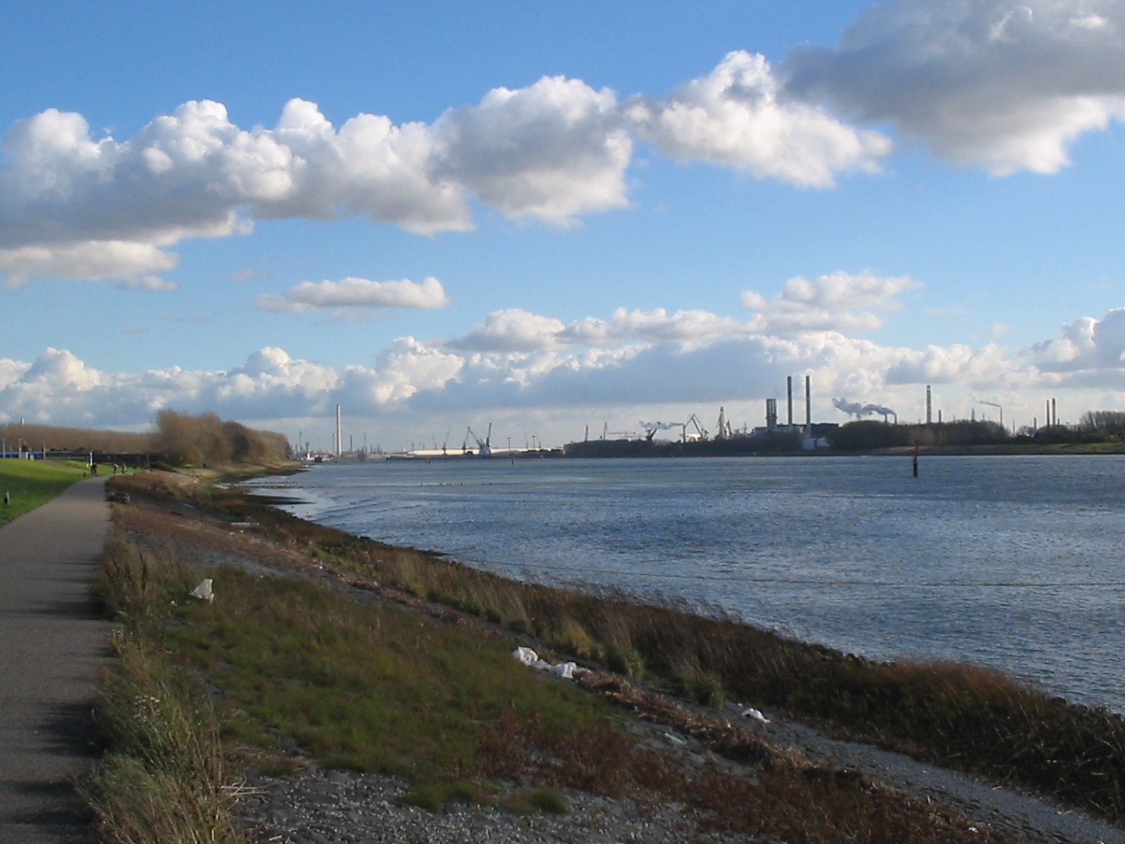
image_caption = Near Maassluis
country = The Netherlands
state = South Holland
length = 10
source_name = Nieuwe Maas
Oude Maas
source_location = Vlaardingen
mouth_name = Nieuwe Waterweg
mouth_location = Rotterdam


map_size = 240px
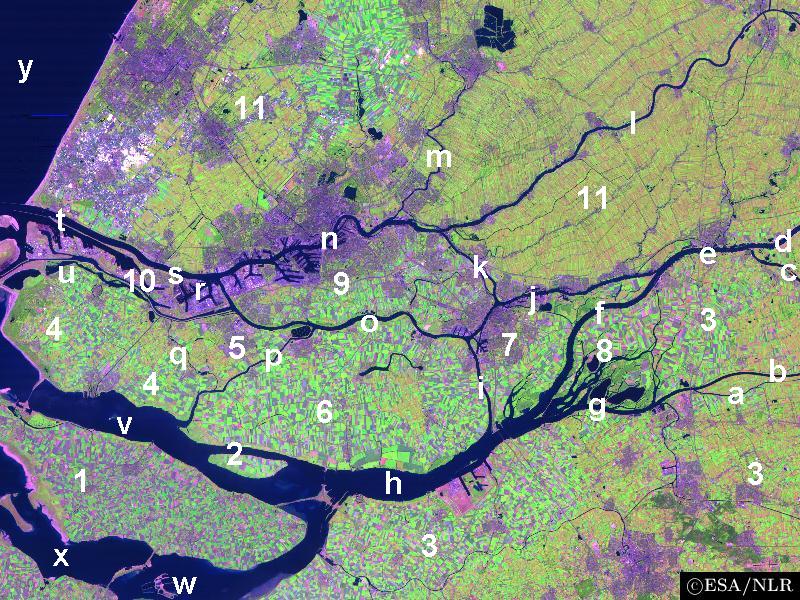
map_caption = Northwest part of the Rhine-Meuse delta showing Het Scheur (s).

Het Scheur (Dutch for "The Rip") is a branch of the Rhine-Meuse delta in South Holland, the Netherlands, that flows west from the confluence of the Oude Maas and Nieuwe Maas branches past the towns of Rozenburg and Maassluis. It continues as the Nieuwe Waterweg (New Waterway) to the North Sea.

Originally, Het Scheur was the northern branch of the river around Rozenburg island and curved south a few kilometres past Maassluis to join the Nieuwe Maas again in the Maasmond ("Mouth of Meuse") estuary near Den Briel. When the Nieuwe Waterweg was completed in 1872, Het Scheur was dammed off and connected to the east end of the Nieuwe Waterweg to form the new channelized main mouth of the Rhine-Meuse delta.


Wikimedia Foundation. 2010.

Игры ⚽ Нужно сделать НИР?

Look at other dictionaries:

  • Nieuwe Maas — New Meuse River …   Wikipedia

  • Oude Maas — Old Meuse River …   Wikipedia

  • Nieuwe Waterweg — Coordinates: 51°56′31″N 4°11′29″E / 51.94194°N 4.19139°E / 51.94194; 4.19139 …   Wikipedia

  • Rozenburg — is also a village in the Dutch municipality of Haarlemmermeer. Infobox Settlement official name = Rozenburg flag size = 120x100px image shield = Rozenburg coa.jpg shield size = 120x100px mapsize = 280px subdivision type = Country subdivision name …   Wikipedia

  • Delta Works — Overview of the Delta Works The Delta Works is a series of construction projects in the southwest of the Netherlands to protect a large area of land around the Rhine Meuse Scheldt delta from the sea. The works consist of dams, sluices, locks,… …   Wikipedia

  • Oosterschelde — For the tall ship, see Oosterschelde (ship). The Oosterschelde (Eastern Scheldt) is an estuary in Zeeland, Netherlands, between Schouwen Duiveland and Tholen on the north and Noord Beveland and Zuid Beveland on the south. During the Roman Era it… …   Wikipedia

  • Dordtsche Kil — The Dordtsche Kil is a short river in South Holland in the Netherlands. The river is tidal and forms the connection between the Oude Maas river and the Hollands Diep. The river is for most part artificial in origin, since it has been a relatively …   Wikipedia

  • Nieuwe Merwede — The projected trajectory of the Nieuwe Merwede canal, circa 1868 (dotted lines). The Nieuwe Merwede ( New Merwede ) is a canal that was constructed in 1870 to form a branch in the Rhine Meuse delta. It was dug along the general trajectories of a… …   Wikipedia

  • Nederrijn — Coordinates: 51°58′11″N 5°21′8″E / 51.96972°N 5.35222°E / 51.96972; 5.35222 …   Wikipedia

  • Oude Rijn (Utrecht and South Holland) — For the Oude Rijn branch in Gelderland Province, see: Oude Rijn (Gelderland). Coordinates: 52°12′43″N 4°23′54″E / 52.21194°N 4.39833°E …   Wikipedia

Share the article and excerpts

Direct link
Do a right-click on the link above
and select “Copy Link”