- Rozenburg
:"Rozenburg is also a village in the Dutch municipality of
Haarlemmermeer ."Infobox Settlement
official_name = Rozenburg
flag_size = 120x100px
image_shield = Rozenburg coa.jpg
shield_size = 120x100px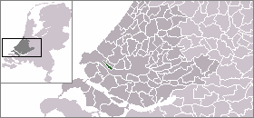
mapsize = 280px
subdivision_type = Country
subdivision_name =Netherlands
subdivision_type1 = Province
subdivision_name1 =South Holland
area_footnotes = (2006)
area_total_km2 = 6.50
area_land_km2 = 4.51
area_water_km2 = 1.98
population_as_of =1 January ,2007
population_note = Source: CBS, [http://statline.cbs.nl/ Statline] .
settlement_type = Municipality
population_total = 12672
population_density_km2 = 2810
timezone = CET
utc_offset = +1
timezone_DST = CEST
latd = 51.90
latNS = N
longd = 4.25
longEW = E
website = [http://www.rozenburg.nl www.rozenburg.nl]
utc_offset_DST = +2).
The town is located on the former island by the same name: Rozenburg Island. Its current form was created out of three separate parts: Rozenburg proper (a former sand bar between
Het Scheur and Brielse Maas - part of theNieuwe Maas river - both branches of theRhine -Meuse delta), the sand bar Welplaat, and the southernmost part of theHook of Holland (which was cut off from mainlandHolland by the construction of theNieuwe Waterweg ship canal in1870 and subsequently was connected to Rozenburg when the remainder of Het Scheur was dammed off). The island is now connected toVoorne-Putten by a sea barrier and a dam.History
Rozenburg Island was formed centuries ago from several sand bars in the mouth of the river
Meuse . In 1568 construction started on the first set of dikes and in 1586 the land known as "Roosenburgh" was leased to Dirk Ariensz. Bisdommer and Son, the first permanent inhabitant of Rozenburg.In 1950, the Nieuwe Maas (or Brielse Maas) was dammed off at both ends of Rozenburg Island, thereby forming Briel Lake and connecting it to
Voorne-Putten Island.Beginning in the same period, most of the island was given to industrial enterprise, part of the
Port of Rotterdam (Botlek andEuropoort ). When these sea ports were being planned in the 1950s, the councils ofRotterdam and Rozenburg made the arrangement that Rotterdam would lead the development of the ports and industry, whereas Rozenburg would look after the housevesting of the expected population increase. The village of Blankenburg on the island had to be completely removed to make way for new canals and industry. The new housing developments were concentrated around the old village centre of Rozenburg on Het Scheur. In a short period its population rose from 3500 to over 14000.The Hook of Holland bit was extended with a large
polder calledMaasvlakte , which contains large sea harbours andpetrochemical industry. Most of the island now belongs to the municipality of Rotterdam.There is a
refinery located in Rozenburg. TheRozenburg refinery is now owned by Kuwait Petroleum Europort BV which is a subsidiary ofKuwait Petroleum International , KPI.External links
* [http://www.rozenburg.nl Official Website]
* [http://www.voorne-putten.nl/rozenburg/ Map (select "plattegrond")]
Wikimedia Foundation. 2010.