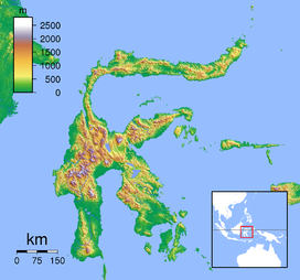
- Soputan
-
Soputan Sulawesi,  Indonesia
Elevation 1,784 m (5,853 ft) [1] Location Coordinates 1°07′N 124°44′E / 1.108°N 124.73°ECoordinates: 1°07′N 124°44′E / 1.108°N 124.73°E[1] Geology Type Stratovolcano Last eruption 2011 Soputan is a stratovolcano in the northern arm of the island of Sulawesi, Indonesia. It sits on the southern rim of the Tondano caldera, constructed in the Quaternary period, and is one of the most active volcanoes in Sulawesi.[1]
In 2004, it erupted with lava oozing down its southwest slope. No fatalities were recorded. On the morning of 6 June 2008, it erupted sending heat clouds of debris as far as 4 km down its slopes, and ash 2 km into the air.[2] It erupted again at 21:03 UTC on 2 July 2011 spewing ash and smoke 5,000 metres into the air.[3]
3 types of Mount Soputan eruption were Explosion, Lava dome and Pyroclastic flow with Strombolian eruption. The eruptions occurred at: 1785, 1819, 1833(?), 1845, 1890, 1901, 1906, 1907, 1908–09, 1910, 1911–12, 1913, 1915, 1917, 1923–24, 1947, 1953, 1966–67, 1968, 1970, 1971, 1973, 1982, 1984, 1985, 1989, 1991–96, 2000–03, 2004, 2005, 2007, 2008 and 2011.[4]
See also
References
- ^ a b c "Soputan". Global Volcanism Program, Smithsonian Institution. http://www.volcano.si.edu/world/volcano.cfm?vnum=0606-03=. Retrieved 2006-12-17.
- ^ "Volcano erupts in Indonesia". Sydney Morning Herald. 7 June 2008. http://news.smh.com.au/world/volcano-erupts-in-indonesia-20080607-2n3n.html. Retrieved 2011-07-03.
- ^ "Indonesian volcano erupts". France 24. July 3, 2011. http://www.france24.com/en/20110703-indonesian-volcano-erupts. Retrieved 2011-07-03.
- ^ http://beritamanado.com/2011/07/03/gunung-berapi-soputan-meletus-sejak-1785/
Categories:- Stratovolcanoes
- Active volcanoes
- Mountains of Indonesia
- Volcanoes of Indonesia
- Indonesia geography stubs
Wikimedia Foundation. 2010.

