Flinders Shire Council

Flinders Shire Council

Infobox Australian Place | type = lga
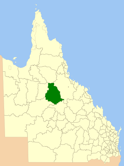
name = Flinders Shire
state = qld


imagesize= 180
caption = Location within Queensland
pop = 2,151 (2001 census)
area = 41422
est =
seat = Hughenden
mayor = Brendan McNamara
region =

url = http://www.flinders.qld.gov.au/index.shtml
stategov = Charters Towers
fedgov = Kennedy
near-nw = Etheridge
near-n = Etheridge
near-ne = Dalrymple
near-w = Richmond
near-e = Dalrymple
near-sw = Winton
near-s = Aramac
near-se = Dalrymple
The Flinders Shire is a Local Government Area in north western Queensland, Australia. Towns in the shire include Prarie, Stamford, Torrens Creek and the administrative centre, Hughenden.

Flinders Shire is predominantly a grazing area with cattle in the north of the shire and mixed grazing to the south in the black soil area. The shire is named for the Flinders River, which passes through the shire.

External links

* [http://www.lgp.qld.gov.au/applications/lgdirectory/CouncilInfo/Default.aspx?OrgCode=FLIN Queensland Department of Local Government & Planning] - Local Government Directory


Wikimedia Foundation. 2010.

Игры ⚽ Нужен реферат?

Look at other dictionaries:

  • Richmond Shire Council — Infobox Australian Place | type = lga name = Richmond Shire Council state = qld imagesize= 180 caption = Location within Queensland pop = 1,020 (2001 census) area = est = seat = Richmond mayor = John Wharton region = url = http://www.richmond.qld …   Wikipedia

  • Winton Shire Council — Infobox Australian Place | type = lga name = Winton Shire state = qld imagesize= 180 caption = Location within Queensland pop = 1,939 area = est = seat = Winton mayor = Bruce Collins region = url = stategov = Mount Isa fedgov = Maranoa near nw =… …   Wikipedia

  • Etheridge Shire Council — Infobox Australian Place | type = lga name = Shire of Etheridge state = qld imagesize= 180 caption = Location within Queensland pop = 1,012 (2005 census) area = 39920 est = 1882 seat = Georgetown mayor = John Smith region = url =… …   Wikipedia

  • Shire of Mornington Peninsula — Victoria Population: 148,394(2009)[1 …   Wikipedia

  • Shire of Croydon — Queensland Location within Queensland Population …   Wikipedia

  • Shire of Dalrymple — Queensland Location within Queensland Population …   Wikipedia

  • Shire of Nebo — Queensland Location within Queensland Population: 2,520 (20 …   Wikipedia

  • Shire of Mornington Peninsula — Lage des Mornington Peninsula Shire in Melbourne Basisdaten Bundesstaat: Victoria Hauptort: Rosebud …   Deutsch Wikipedia

  • Shire of Aramac — Infobox Australian Place | type = lga name = Shire of Aramac state = qld imagesize= 180 caption = Location within Queensland pop = 734 density = area = 23361 est = seat = Aramac mayor = Gary Peoples region = Central Queensland logosize = 125 url …   Wikipedia

  • Shire of Cook — Queensland Location within Queensland Population: 3,976(201 …   Wikipedia

Share the article and excerpts

Direct link
Do a right-click on the link above
and select “Copy Link”