- Kawaba, Gunma
Japanese city
Name = Kawaba
JapaneseName = 川場町
Prefecture =Gunma Prefecture
Region = Kantō
Area_km2 = 85.29
Population = 4124
PopDate =September 1 ,2007
Density_km2 = 48.35
Coords = coord|36|42|N|139|6|E|region:JP_type:city
Postal code =
Area code =
Mayor =
Tree =
Flower =
Bird =
Symbol
CityHallPostalCode = 378-0101
CityHallAddress = Kawaba-mura, 2390-2 Ōaza Tanichi
CityHallPhone = 0278-52-2111
CityHallLink = [http://www.vill.kawaba.gunma.jp/ Kawaba Village]
City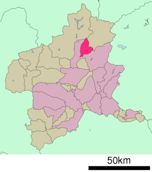
Elevation =nihongo|Kawaba|川場村|Kawaba-mura is a village located in Tone District, Gunma,
Japan .As of
September 1 ,2007 , the village has an estimatedpopulation of 4,124 and a density of 48.35 persons per km². The total area is 85.29 km².Geography
Situated in northern
Gunma prefecture , the village is in a rather mountainous area. 83% of it is covered by forests, and five rivers, the Tashiro River, the Sakura River, the Tazawa River, the Usune River, and the Mizomata River flow through. Kawaba, meaning "the place of the rivers" is thought to be named after its many streams. The climate is cool, with an average yearly temperature of 11.0℃ and a snowfall of 2~3 m.*
Mountains :Mount Hotaka
*Rivers :Tashiro River, Sakura River, Tazawa River, Usune River, Mizomata Riverurrounding municipalities
*
Gunma Prefecture
** Numata
** Katashina
** MinakamiNotable places
* Kichijō temple
* Kawaba Ski Resort
* Roadside Station Kawaba Denen Plazaister cities
* Setagaya,
Tokyo External links
*ja icon [http://www.vill.kawaba.gunma.jp/ Kawaba Official Site]

Wikimedia Foundation. 2010.