- Vorkuta Airport
Infobox Airport
name = Vorkuta Airport
nativename =
nativename-a = Аэропорт Воркута
nativename-r =
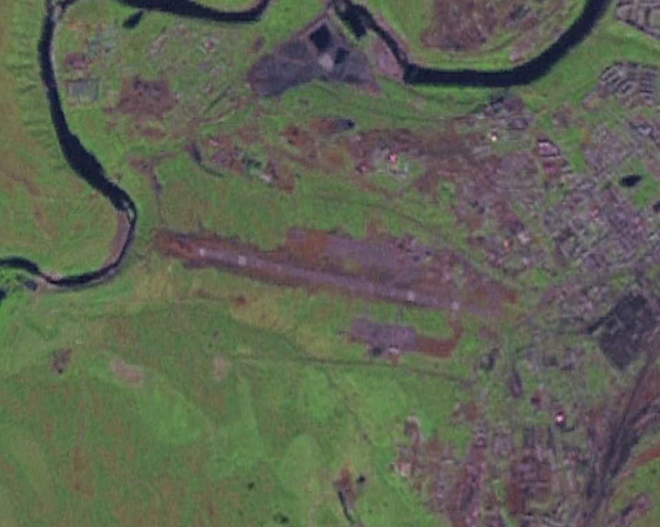
image-width =
caption =
IATA = VKT
ICAO = UUYW
type = Public
owner =
operator = Vorkuta branch of FSUE "Komiaviatrans"
city-served =
location = Vorkuta
elevation-f = 604
elevation-m = 184
coordinates = Coord|67|29|18|N|063|59|24|E|region:RU-KO_type:airport|display=inline,title
website =
metric-elev =
metric-rwy =
r1-number = 08/26
r1-length-f = 6,217
r1-length-m = 1,895
r1-surface =Asphalt
stat-year =
stat1-header =
stat1-data =
stat2-header =
stat2-data =
footnotes =Vorkuta Airport ( _ru. Аэропорт Воркута) airport codes|VKT|UUYW is a small airport in the
Komi Republic ,Russia located 3 km west ofVorkuta . It services small airliners. The pavement length is 2200 meters, however it is shortened 300 m due to a displaced threshold.Airlines and Destinations
*
Komiinteravia (Syktyvkar)ee also
*
Yamburg Airport References
* [http://www.farecompare.com/flights/Vorkuta-VKT/city.html Vorkuta Destinations]
* [http://aero.autotp.ru/cgi-bin/db.cgi?db=nav&uid=default&view_records=1&ID=204&ww=on Vorkuta Airport at Russian Airports Database]External links
* [http://www.fallingrain.com/world/RS/34/Vorkuta.html Vorkuta Airport at fallingrain.com]
* [http://gc.kls2.com/airport/VKT Great Circle Mapper: NOZ / UNYW - Vorkuta, Vorkuta, Russian Federation (Russia)]
* ASN [http://aviation-safety.net/database/airport/airport.php?id=vkt Accident history for UNYW]
* [http://www.tutiempo.net/en/Climate/VORKUTA/232260.htm Historical Weather Records for Vorkuta]
Wikimedia Foundation. 2010.