- Khatlon
Geobox Region
name = Khatlon
native_name =
other_name =
other_name1 =
category =
image_size =
image_caption =
flag_size =
symbol =
symbol_size =
country = Tajikistan
state =
region =
district =
capital =Qurghonteppa (Kurgan-Tyube)
capital_type = Capital
capital_lat_d =
capital_lat_m =
capital_lat_s =
capital_lat_NS =
capital_long_d =
capital_long_m =
capital_long_s =
capital_long_E =
capital_elevation =
city_type =
city =
part_type =
part_count =
part =
part1 =
area = 24800
highest =
highest location =
highest_lat_d =
highest_lat_m =
highest_lat_s =
highest_lat_NS =
highest_long_d =
highest_long_m =
highest_long_s =
highest_long_EW =
highest_elevation =
lowest =
lowest_location =
lowest_lat_d =
lowest_lat_m =
lowest_lat_s =
lowest_lat_NS =
lowest_long_d =
lowest_long_m =
lowest_long_s =
lowest_long_EW =
lowest_elevation =
population_as_of = 2008
population = 2579300
population_density = 104.0
established_type =
established =
leader_type =
leader =
timezone =
utc_offset =
timezone_DST =
utc_offset_DST =
code_type =ISO 3166-2
code = TJ-KT
code1_type =
code1 =
free_type =
free =
free1_type =
free1 =
map_size = 200
map_caption =
map_locator =
map_locator_x =
map_locator_y =
map_first = 1
website =
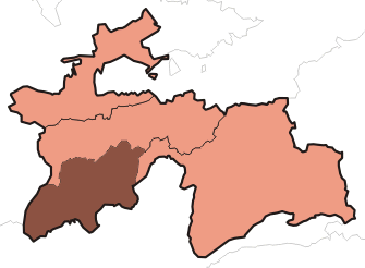
footnotes =Khatlon (TaPA: Хатлон/ختلان), sometimes misspelt "Khatlan", is the most populous of the four administrative divisions and one of the three provinces ( _tg. вилоятҳо, "viloyatho") in
Tajikistan . It is situated in the southwest of the country, between the Hisor (Gissar) Range in the north and thePanj River in the south and borders onAfghanistan in the southeast and onUzbekistan in the west. During Soviet times Khatlon was divided into Kurgan-Tyube (Qurghonteppa) Oblast (Western Khatlon) – with theKofarnihon and Vakhsh river valleys – andKulob Oblast (Eastern Khatlon) – with the Kyzylsu and Yakhsu river valleys. Both regions were merged in November 1992 into Khatlon Oblast. The capital is the city ofQurghonteppa , formerly known asKurgan-Tyube .Khatlon has an area of 24,800 square kilometres and consists of 24 districts – 14 in Western Khatlon and 10 in Eastern Khatlon. The total population of Khatlon in 2008 was 2,579,300,"Population of the Republic of Tajikistan as of 1 January 2008", State Statistical Committee, Dushanbe, 2008 ru icon] up from 2,149,500 in the 2000 population census. The population in Khatlon is mainly engaged in agricultural activities, especially
cotton growing andcattle raising. Only two or three percent of the population work in the industrial sector.History
During the
Soviet era, Khatlon became one of the two main cotton regions in Tajikistan. The other one is inSughd (Leninabad). Collectivisation of agriculture was implemented aggressively in the early 1930s, to expand the extent of cotton cultivation in Tajikistan as a whole, with particular emphasis on the southern part of the republic. The process included violations against peasants, substantial expansion of theirrigation network, and forcible resettlement of mountain peoples and people fromUzbekistan to the lowlands.Muriel Atkin . "Tajikistan" in: Glenn E. Curtis (ed.): Kazakstan, Kyrgyzstan, Tajikistan, Turkmenistan, and Uzbekistan, Country Studies, Washington:1997 . pp. 197-290. ]The results of this policy are to be seen in the ethnic composition of Salua oblast as well as in the fact that the Tajik population identifies themselves either as
Gharmis (resettled from the mountains) orKulobis . These groups never melted, and fought against each other during theCivil War in Tajikistan . Khatlon oblast suffered the heaviest damage in Tajikistan.Since the conflicts leading to the civil war were never really resolved, tensions in the region still exist. The eastern part –
Kulob – is home to the president and his clan and has thus gained a lot of political influence. During Soviet times, the region cooperated with the then ruling elite from Leninabad, and was responsible for the militia, the army and the security forces.Kulob is regarded as a very conservative region. In the capitalQurghonteppa and parts of Kulob, theIslamic opposition has a lot of support among the Garmis.The "Kulyab clan" is a
clan based inKhatlon ,Tajikistan . [http://ismaili.net/mirrors/112_tajik/tajkethn.html Ethnic groups at risk: The status of Tajiks] Heritage Society] In February 1996 ColonelMahmud Khudoiberdiyev launched a rebellion, insisting that three officials from the Kulyab clan resign before he ended the rebellion. The government complied. Additionally, Prime MinisterDzhamshed Karimov and Abudzhalil Khamidov, the Chairman of the Leninabad oblast executive committee, resigned. [http://jamestown.org/print_friendly.php?volume_id=3&issue_id=125&article_id=1480 Tajikistan: Central Asian Powderkeg] The Jamestown Foundation]Districts
*
Baljuvon district
*Bokhtar district
*Vakhsh district
*Vose' district
*Danghara district
*Yovon district
*Rumi district (Kolkhozobod district)
*Hamadoni district (Moskovskiy district)
*Kulob district
*Qabodiyon district
*Qumsangir district
*Muminobod district
*Norak district
*Nosiri Khisrav district (Beshkent district)
*Panj district
*Sarband district
*Farkhor district
*Temurmalik district (Qizil-Mazor district, Sovetskiy district)
*Khovaling district
*Khuroson district (Ghozimalik district)
*Dzhami (Jomi) district
*Jilikul district
*Shahrtuz district
*Shuro-obod district Demography
The ethnic composition of Kulob region is: 85 %
Tajiks , 13 %Uzbeks , 2 % others. In Qurghonteppa the breakdown is 59 % Tajiks, 32 % Uzbeks and three percentRussia n.ee also
*
2006 Tajikistan earthquake References
Wikimedia Foundation. 2010.