- Nižná Boca
-
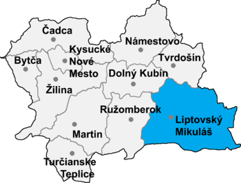
Nižná Boca is a village and municipality in Liptovský Mikuláš District in the Žilina Region of northern Slovakia.
History
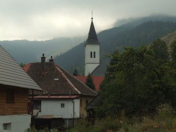
In historical records the village was first mentioned in [1285]]. Nižná Boca Village is situated on both banks of the river Boca. It is surrounded by slopes of nearby mountains Oleškovej, Špíglovô, Solisko, Fišiarka, distillery, baldness, Črchle, Straight or Chopec hola. The area is situated in a protected area in the Low Tatras National Park. Near the village are meadows and small rolls. The soil is poor. Potatoes are often harvested as much as inflicted. Under difficult circumstances, and planted crops grown were exposed to severe weather conditions. Boca's inh The population was addressed mainly to cattle and sheep. A special feature is a rarity, even the fact that citizens have cattle for short time next to their homes, as well as directly on grassland in special loghouses - meadow stables. About 50 of these meadow stables can be seen scattered throughout the valley. Some are still functional and in good condition. Efforts is currently underway to rescue, reconstruction and documentation of the original architecture.
Geography
The municipality lies at an altitude of 851 metres and covers an area of 25.172 km². It has a population of about 178 people.
External links
Liptovský Hrádok · Liptovský Mikuláš
Beňadiková · Bobrovček · Bobrovec · Bobrovník · Bukovina · Demänovská Dolina · Dúbrava · Galovany · Gôtovany · Huty · Hybe · Ižipovce · Jakubovany · Jalovec · Jamník · Konská · Kráľova Lehota · Kvačany · Lazisko · Liptovská Anna · Liptovská Kokava · Liptovská Porúbka · Liptovská Sielnica · Liptovské Beharovce · Liptovské Kľačany · Liptovské Matiašovce · Liptovský Ján · Liptovský Ondrej · Liptovský Peter · Liptovský Trnovec · Ľubeľa · Malatíny · Malé Borové · Malužiná · Nižná Boca · Partizánska Ľupča · Pavčina Lehota · Pavlova Ves · Podtureň · Pribylina · Prosiek · Smrečany · Svätý Kríž · Trstené · Uhorská Ves · Vavrišovo · Važec · Veľké Borové · Veterná Poruba · Vlachy · Východná · Vyšná Boca · Závažná Poruba · Žiar
Coordinates: 48°57′N 19°46′E / 48.95°N 19.767°E
Categories:- Villages and municipalities in Liptovský Mikuláš District
- Žilina Region geography stubs
Wikimedia Foundation. 2010.


