- Zeehan, Tasmania
Infobox Australian Place | type = town
name = Zeehan
state = tas

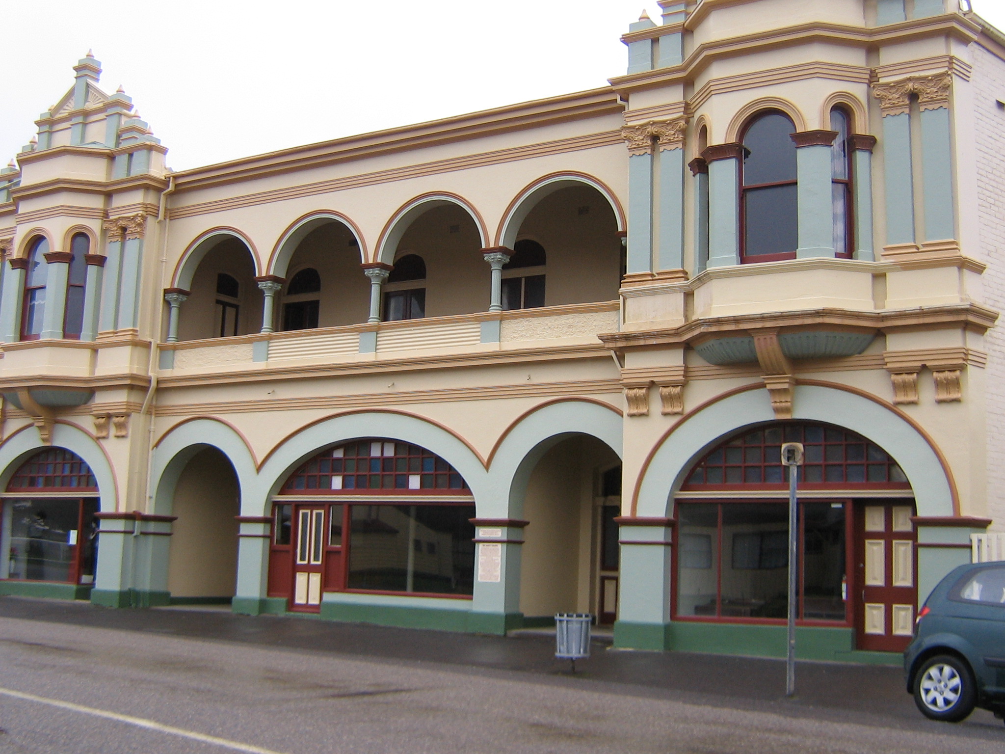
caption = The former Gaiety Theatre at Zeehan, part of the West Coast Pioneers Museum.
lga = West Coast Council
postcode = 7469
est =
pop = 845
pop_footnotes=
elevation= 172
elevation_footnotes= [ [http://www.bom.gov.au/climate/averages/tables/cw_097016.shtml Bureau of Meteorology] . Retrieved on2007-11-17 .]
maxtemp = 15.2
mintemp = 6.3
rainfall = 2445.5
stategov = Lyons
fedgov = Lyons
dist1 = 286
dir1 = NW
location1= Hobart
dist2 = 139
dir2 = SW
location2= Burnie
dist3 = 38
dir3 = NW
location3= QueenstownZeehan is a town on the west coast of
Tasmania ,Australia . It lies convert|139|km|mi|0|lk=on southwest of Burnie. At the 2006 census, Zeehan had a population of 845.Census 2006 AUS
id=UCL619600 |name=Zeehan (L) (Urban Centre/Locality)|accessdate=2007-11-17|quick=on] It is part of the Municipality of West Coast.The town was named after the nearby
Mount Zeehan which had been named byGeorge Bass andMatthew Flinders afterAbel Tasman 'sbrig "Zeehaen".History
The region has one of the oldest histories of any part of Tasmania, when Abel Tasman sighted this part of the state in 1642. An early port for Zeehan was
Trial harbour but it was very precarious in its location onOcean Beach and was taken over by Strahan. Zeehan saw a boost in population when the Zeehan-Dundassilver -lead deposits were found in 1882 byFrank Long . This rush lasted until the closure of the last mine in 1914. During the time the population peaked at 10,000, over ten times the current population.It was clearly in competition with the town further south, Queenstown, and while the silver boom lasted it was known as the "Silver City". In the first decade of the twentieth century it was on a par with Launceston and Hobart for size. With a main street over two miles long (3.2 km); it also claimed over 20 hotels. In the 1970s it saw increased activity due to operations at the nearby
Renison Bell Tin mine, and again in the 1990s.Railways
Zeehan was an important railway location — the end of the
Emu Bay Railway , and the beginning of the government-ownedStrahan-Zeehan Railway service that connected to Strahan andRegatta Point , where theMount Lyell Railway connected to Queenstown. Also at early stages of the town's history, a series of timber trams spread out from Zeehan towards thePieman River as well as a number of other locations.Some of the smaller railway operations east of Zeehan were unique. One had the honour of having the first
Garratt steam engine designed and built for its operations.After the Government rail connection between Zeehan and Strahan closed, the Mount Lyell Company trucked its copper ore to the Emu Bay Railway terminus at Melba Flats, a few kilometres east of Zeehan.
Newspapers
:"See the article:
Zeehan and Dundas Herald "Economy
Allegiance Limited Aveburynickel mine, Zeehan Zinc'sComstock Mine and the Bluestone Tin'sRenison Bell tin mine are significant economic contributors to the community, but the majority of the town relies ontourism for its survival.Tourism features
Among these attractions is the "West Coast Pioneers Museum", which is in the old "School of Mines" building.The main streetscape of Zeehan is one significant feature of the town.
ee also
*
Railways on the West Coast of Tasmania
*West Coast Tasmania Mines References
Further reading
*
*
*: 2003 edition - Queenstown: Municipality of Queenstown. :1949 edition - Hobart: Davies Brothers. OCLC|48825404;ASIN [http://www.amazon.com/dp/B000FMPZ80 B000FMPZ80] :1924 edition - Queenstown: Mount Lyell Tourist Association. OCLC|35070001;ASIN [http://www.amazon.com/dp/B0008BM4XC B0008BM4XC]
** "Railways of the Zeehan District" Manny, L.B. Australian Railway Historical Society Bulletin, October/November, 1963
Wikimedia Foundation. 2010.
