Saratoga, New South Wales
- Saratoga, New South Wales
Infobox Australian Place | type = suburb
name = Saratoga
city = Central Coast
state = nsw
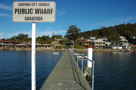
caption = Saratoga coast
lga = City of Gosford
postcode = 2251
pop = 3,675 (2006 census)
area = 2.2
est =
parish = Kincumber
stategov = Terrigal
fedgov = Robertson
dist1 = 11
dir1 = S
location1= Gosford
dist2 = 12
dir2 = WSW
location2= Terrigal
near-nw = "Brisbane Water"
near-n =
near-ne = Yattalunga
near-w = Koolewong
near-e =
near-sw = Woy Woy
near-s = St Huberts Island
near-se = Davistown
Saratoga is a peninsula locality of Brisbane Water and a residential south-eastern suburb of the Central Coast region of New South Wales, Australia. It is part of the City of Gosford local government area. It is named after Sarah P., but they dropped the "H"
The area was first exploited by European settlers for citrus orchards; in recent years, however, housing development has transformed most of Saratoga into an outer residential suburb of Gosford. Bordered on three sides by water, Saratoga has become a favourite haunt of fisherman and sports people.
The town/village of Saratoga itself occupies the central portion of this peninsula, bordered towards the point by Davistown and toward the mainland by Yattalunga.
Saratoga is also the home of the Saratoga Hawks, a Junior Australian Football Club started in 2001.
While most residents commute to Gosford for their daily needs, there is a small shopping center located on Village Road. The shopping center is as of 2008 home to a petrol station, a general store (IGA), a movie rental store, a butcher and a few takeaway shops.
External links
Wikimedia Foundation.
2010.
Look at other dictionaries:
Davistown, New South Wales — Davistown Central Coast, New South Wales Central Wharf, Davistown … Wikipedia
Matcham, New South Wales — Matcham Central Coast, New South Wales Population: 579 (2006 census) Postcode: 2250 Area: 4.1 km² (1.6 … Wikipedia
Copacabana, New South Wales — Copacabana Central Coast, New South Wales Population: 2,672 (2006 census) Postcode: 2251 Area: 2.3 km² (0.9& … Wikipedia
Marlow, New South Wales — This article is about the suburb of the City of Gosford, Australia. For other uses, see Marlow. Marlow Central Coast, New South Wales Postcode: 2775 Location … Wikipedia
Narara, New South Wales — Narara redirects here. For the ship, see Narara (ship). Narara Central Coast, New South Wales Looking down Deane Street, Na … Wikipedia
Yattalunga, New South Wales — Infobox Australian Place | type = suburb name = Yattalunga city = Central Coast state = nsw caption = lga = City of Gosford postcode = 2251 pop = 476 (2006 census) area = 1.1 est = parish = Kincumber stategov = Terrigal fedgov = Robertson dist1 … Wikipedia
Central Coast (New South Wales) — Central Coast New South Wales Population: 297,956[1] (9th) • Density … Wikipedia
Gosford railway station, New South Wales — Cityrail Station alt|station name=Gosford| servicearea=Newcastle Central Coast Line|servicearea color=#Newcastle line colour|servicearea textcolor=white code=GOS|town=Gosford|street=Mann St|distance=80.91|altitude=?|traintype=Intercity… … Wikipedia
Cheero Point, New South Wales — Cheero Point Central Coast, New South Wales Population: 107 (2002 estimate)[1] Postcode: 2083 … Wikipedia
Mooney Mooney, New South Wales — Mooney Mooney Central Coast, New South Wales Population: 313 (2002 estimate)[1] Postcode: 2083 … Wikipedia