- Lake Chamo
-
Lake Chamo 
Coordinates 5°50′N 37°33′E / 5.833°N 37.55°ECoordinates: 5°50′N 37°33′E / 5.833°N 37.55°E Basin countries Ethiopia Max. length 32 km Max. width 13 km Surface area 317 km² Max. depth 14 m Surface elevation 1,110 m Lake Chamo (Chamo Hayk in Amharic) is a lake in the Southern Nations, Nationalities, and Peoples Region of southern Ethiopia. It is located in the Great Rift Valley at an elevation of 1,110 meters. It is just to the south of Lake Abaya and the city of Arba Minch, and east of the Guge Mountains.
The lake's northern end lies in the Nechisar National Park. According to figures published by the Central Statistical Agency, Lake Chamo is 32 kilometers long and 13 wide, with a surface area of 317 square kilometers and a maximum depth of 14 meters with a catchment of about 18757 square kilometers in size.[1] [2] Other sources locate it on an elevation of 1,235 meters with a length of 26 km a widths of 22 km an area of 551 square kilometers a chatchment of 2220 square kilometers and a maximum depth of 10 meters.[3] The lake is fringed with beds of Typha, as well as wetlands. The lake is fed by the Kulfo River and several small streams, as well as overflow from Lake Abaya brought to it by the Ualo River.[4] Oscar Neumann, exploring the area in 1901, found a dry channel connecting Lake Chamo to the Sagan River, which led him to conclude the lake contributes to the Sagan in years of heavy rainfall.[5]
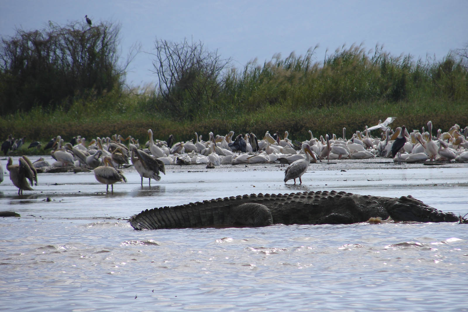
Wildlife include fish like the catfish Bagrus docmac and Nile perch, as well as hippopotamus and Nile crocodiles.[4]
 Crocodiles at Lake Chamo
See also
Notes
- ^ "Water Resources and Irrigation Development in Ethiopia - IWMI", Table 3. Basic hydrological data of lakes and reservoirs of Ethiopia. (accessed 02 July 2011)
- ^ Google Earth
- ^ "Climate, 2008 National Statistics (Abstract)", Table A.2. Central Statistical Agency website (accessed 26 December 2009)
- ^ a b Robert Mepham, R. H. Hughes, and J. S. Hughes, A directory of African wetlands, (Cambridge: IUCN, UNEP and WCMC, 1992), p. 163
- ^ Oscar Neumann, "From the Somali Coast through Southern Ethiopian to the Sudan", Geographical Journal, 20 (October 1902), pp. 373-398
External links
Categories:- Lakes of Ethiopia
- Lakes of the Great Rift Valley
- Southern Nations, Nationalities, and People's Region
- Southern Nations, Nationalities, and People's Region geography stubs
Wikimedia Foundation. 2010.