- Tacoma Narrows Airport
Infobox Airport
name = Tacoma Narrows Airport
nativename =
nativename-a =
nativename-r =
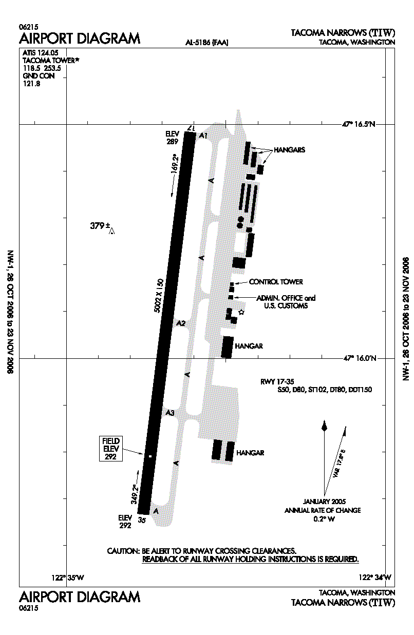
image-width =
caption =
IATA = TIW
ICAO = KTIW
FAA = TIW
type = Public
owner =
operator = City of Tacoma
city-served =
location = Tacoma, Washington
elevation-f = 292
elevation-m = 89
coordinates = Coord|47|16|05|N|122|34|41|W|type:airport_region:US|display=inline,title
website =
metric-elev =
metric-rwy =
r1-number = 17/35
r1-length-f = 5,002
r1-length-m = 1,525
r1-surface =Asphalt / Aggregate
stat-year =
stat1-header =
stat1-data =
stat2-header =
stat2-data =
footnotes =Tacoma Narrows Airport Airport codes|TIW|KTIW|TIW is a public
airport located four miles (6.4 km) west of Tacoma, serving Pierce County,Washington , USA. The airport is mostly used forgeneral aviation .Facilities
Tacoma Narrows Airport covers convert|644|acre|ha|0|lk=on and has one
runway :
* Runway 17/35: 5,002 x 150 ft. (1,525 x 46 m), Surface:Asphalt / AggregateReferences
*FAA-airport|ID=TIW|use=PU|own=PU|site=26434.4*A
External links
Wikimedia Foundation. 2010.