- Felts Field Airport
Infobox Airport
name = Felts Field Airport
nativename =
nativename-a =
nativename-r =
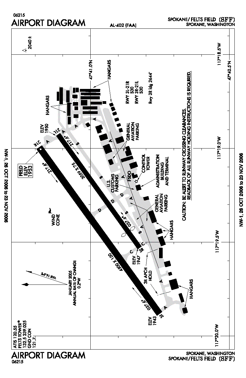
image-width =
caption =
IATA = SFF
ICAO = KSFF
type = Public
owner =
operator =
city-served = Spokane
location = Spokane, Washington
elevation-f = 1,953
elevation-m = 595
coordinates = Coord|47|40|58.1452|N|117|19|21.2103|W|type:airport|display=inline,title
website =
metric-elev =
metric-rwy =
r1-number = 3L/21R
r1-length-f = 4,500
r1-length-m = 1,372
r1-surface = Concrete
r2-number = 3R/21L
r2-length-f = 3,059
r2-length-m = 932
r2-surface = Asphalt
r3-number = 3W/21W
r3-length-f = 6,000
r3-length-m = 1,829
r3-surface = Water
stat-year =
stat1-header =
stat1-data =
stat2-header =
stat2-data =
footnotes =Felts Field Airport Airport codes|SFF|KSFF is a public
airport located inSpokane, WA serving Spokane County,Washington , USA. The airport has two hard surfacerunway s and one runway on theSpokane River . Felts Field is primarily used forgeneral aviation .Facilities
Felts Field Airport has three runways:
* Runway 3L/21R: 4,500 x 150 ft (1,372 x 46 m). Surface:Concrete
* Runway 3R/21L: 3,059 x 75 ft (932 x 23 m). Surface:Asphalt
* Runway 3W/21W: 6,000 x 100 ft (1,829 x 30 m). Surface:Water Additionally, there is an unofficial
sod runway located between the two paved runways, between taxiways Alpha and Delta, adjacent to the north side of runways 3R/21LHistory
During
World War II the airfield was used by theUnited States Army Air Force ee also
*
Washington World War II Army Airfields References
* [http://www.gcr1.com/5010web/airport.cfm?Site=SFF Airport Master Record (FAA Form 5010)] , also available as a [http://www.gcr1.com/5010web/REPORTS/AFD09282006SFF.pdf printable form] (PDF)
External links
* [http://www.nps.gov/history/nr/travel/aviation/ Aviation: From Sand Dunes to Sonic Booms, a National Park Service "Discover Our Shared Heritage" Travel Itinerary]
Wikimedia Foundation. 2010.