- 1967 Atlantic hurricane season
Infobox hurricane season
first storm formed=August 28 ,1967
last storm dissipated=October 31 ,1967
strongest storm=Beulah - 923mbar (27.26inHg ), 160mph (260km/h )
total storms=8
major storms=1
total daUSD )
$1.24 billion (2005 USD)
total fatalities=64
basin=Atlantic hurricane
five seasons=1965, 1966, 1967, 1968, 1969 The 1967 Atlantic hurricane season officially began onJune 1 ,1967 , and lasted untilNovember 30 ,1967 . These dates conventionally delimit the period of each year when mosttropical cyclone s form in theAtlantic basin . The season was fairly average, with eight storms forming.Hurricane Beulah was the most notable Atlantic hurricane of 1967. A Category 5 hurricane, it killed 58 and did $217 million ($1.2 billion in 2005US dollars ) in damage as it crossed theYucatán Peninsula and then made landfall a second time near the mouth of theRio Grande .torms
Hurricane Arlene
Infobox Hurricane Small
Basin=Atl.jpg)
Track=Arlene 1967 track.pngAugust 28
Dissipated=September 4
1-min winds=75
Pressure=982Intertropical Convergence Zone (ITCZ) became very active, with four separate areas of convection exiting the coast of Africa. The first, accompanied with a tropical wave, became a tropical depression onAugust 28 (the second became Beulah and the fourth became Chloe). The tropical depression moved west-northward, reaching tropical storm strength on the 30th. Arlene slowly strengthened over the following days, eventually reaching hurricane intensity on the 3rd over the north Atlantic. The next day, it weakened to a tropical storm and became extratropical. It was absorbed by a warm front, leaving behind a slow-moving frontal low.Hurricane Beulah
Infobox Hurricane Small
Basin=Atl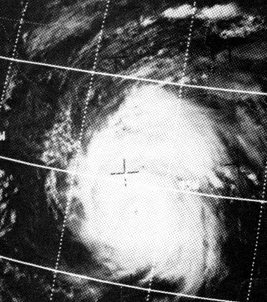
Track=Beulah 1967 track.pngSeptember 5
Dissipated=September 22
1-min winds=140
Pressure=923September 5 th east of the Lesser Antilles. It moved slowly through the islands and became Tropical Storm Beulah onSeptember 7 . Beulah reached hurricane strength the next day while moving slowly west-northwestward and continued to intensify rapidly, reaching an initial peak of 150 mph (240 km/h) winds while south of theMona Passage . It passed south of Hispaniola, where land interaction and upper level shear greatly weakened the hurricane to a 60 mph tropical storm.Favorable conditions returned once again over the western Caribbean, letting Beulah strengthen to a 115 mph (185 km/h) major hurricane. On
September 16 th, Beulah weakened and made landfall nearCozumel, Mexico as a 100 mph (160 km/h) hurricane. It weakened slightly over land, but once over the Gulf of Mexico, conditions were very favorable. It rapidly intensified, reaching its peak as a Category 5 storm with 160 mph (260 km/h) winds. However, unfavorable environmental conditions caused it to make landfall just north of the mouth of theRio Grande as aCategory 3 storm. The "S.S. Shirley Lykes" reported winds of 136 mph as the storm passed over the port atBrownsville, Texas .Ultimately, Hurricane Beulah caused 58 deaths and $217 million in damage ($1.1 billion in 2000 USD).
Hurricane Chloe
Infobox Hurricane Small
Basin=Atl.jpg)
Track=Chloe 1967 track.pngSeptember 5
Dissipated=September 21
1-min winds=95
Pressure=958September 5 nearCape Verde . On the 8th, after passing through Cape Verde, it became a tropical storm, and the following day, a hurricane. At this time, Chloe interacted with Hurricane Doria to its west, turning Chloe northward. It moved out to sea, becoming extratropical on the 21st over the eastern Atlantic.Hurricane Doria
Infobox Hurricane Small
Basin=Atl.jpg)
Track=Doria 1967 track.pngSeptember 8
Dissipated=September 21
1-min winds=75
Pressure=973Florida in early September. Over the next days, it drifted over the warmGulf Stream waters, gradually transforming it to more tropical in nature. OnSeptember 8 , it was well-organized enough to be called a tropical depression, 50 miles north ofGrand Bahama Island . It drifted to the west-southwest, reaching tropical storm strength the next day. Soon after, Doria moved rapidly northeastward, becoming a hurricane on the 10th while 200 miles east of the Florida/Georgia border. It weakened to a tropical storm due to cool air entraining the circulation on the 11th, but on the 12th it was able to re-strengthen. Building high pressures to Doria's northeast pushed Doria westward towards the coast. It weakened to a tropical storm again due to cold air, just prior to reaching theVirginia coastline. It made landfall on the 16th, and continued southward through theOuter Banks . Doria weakened further to a tropical depression on the 17th, retaining its circulation for 4 days before dissipating on the 21st. Doria claimed three lives when a small boat sank off the coast ofNew Jersey .Tropical Storm Edith
Infobox Hurricane Small
Basin=Atl.jpg)
Track=Edith 1967 track.pngSeptember 26
Dissipated=October 1
1-min winds=50
Pressure=1000Intertropical Convergence Zone disturbance led to the formation of a tropical depression onSeptember 26 , east of theLesser Antilles . 2 days later it became Tropical Storm Edith. After reaching a peak of 60 mph Edith passed under a cold upper trough, weakening Edith to a depression on the 30th before passing through the islands. Tropical Depression Edith dissipated onOctober 1 in the easternCaribbean Sea .Hurricane Fern
Infobox Hurricane Small
Basin=Atl
Track=Fern 1967 track.pngOctober 1
Dissipated=October 4
1-min winds=75
Pressure=987Gulf of Mexico in late September. It organized around an area of low pressure, becoming a tropical depression onOctober 1 in theBay of Campeche . Moving northward, it became Tropical Storm Fern on the 2nd, and the following day, Hurricane Fern. Fern moved more to the west after reaching its peak of 85 mph winds, reaching unfavorable conditions caused by Beulah 2 weeks earlier. Thus, Fern weakened to a tropical storm prior to itsTampico landfall on the 4th, dissipating later that day. Fern caused three deaths due to drowning.Tropical Storm Ginger
Infobox Hurricane Small
Basin=Atl
Track=Ginger 1967 track.pngOctober 5
Dissipated=October 8
1-min winds=45
Pressure=1002October 5 in the far eastern Atlantic. It moved northeastward. [cite web |accessdate= 2007-11-07 |title= 1967 Hurricane/Tropical Data for Atlantic | url=http://weather.unisys.com/hurricane/atlantic/1967/index.html | date=2005-01-01 |publisher= unisys] , becoming Tropical Storm Ginger the next day; this is the farthest east that a tropical cyclone has ever formed during October in the Atlantic untilHurricane Vince . After peaking at 50 mph the storm weakened, dissipating on the 8th.Hurricane Heidi
Infobox Hurricane Small
Basin=Atl
Track=Heidi 1967 track.pngOctober 19
Dissipated=November 1
1-min winds=80
Pressure=981October 19 . It became a tropical storm the following day, and a hurricane three days later as Heidi recurved to the northeast. From the 25th to the 30th, it mostly stalled due to a high pressure system over southeasternCanada . Dry air and cooler waters from upwelling weakened Heidi to a tropical storm on the 29th, and on the 31st, Heidi became extratropical.torm names
The following names were used for named storms (tropical storms and hurricanes) that formed in the North Atlantic in 1967. Names that were not assigned are marked in tcname unused.
Retirement
At the end of the season, the name Beulah was retired and replaced with Beth in the 1971 season.
See also
*
List of Atlantic hurricanes
*List of Atlantic hurricane seasons Notes
External links
* [http://www.aoml.noaa.gov/general/lib/lib1/nhclib/mwreviews/1967.pdf Monthly Weather Review]

Wikimedia Foundation. 2010.