- Montseny
-
Montseny 
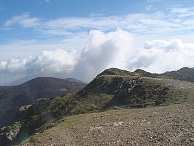
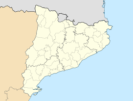
View from the summit of El MatagallsElevation 1,706 m (5,597 ft) Location Vallès Oriental, la Selva, Osona
( Catalonia)
Range Catalan Pre-Coastal Range Coordinates 41°47′36″N 2°24′11″E / 41.79333°N 2.40306°ECoordinates: 41°47′36″N 2°24′11″E / 41.79333°N 2.40306°E Geology Type Sedimentary rock layers over igneous and metamorphic rocks[1] Montseny (Catalan pronunciation: [munˈsɛɲ]) is a mountain range west of the coastal hills north of Barcelona. It is part of the Catalan Pre-Coastal Range.
Features
The Montseny massif is located within a triangle formed by the AP-7, C-17 and C-25 roads. It has the highest mountains in the area south of the Pyrenees and dominates the plains south of Girona.
UNESCO designated Montseny a biosphere reserve in 1978.[2] The regional government designated it a natural park in 1987.
The highest peaks are Turó de l'Home (1,712 m), Les Agudes (1,703 m), El Matagalls (1,697 m) and Puig Drau (1,344 m). To the south is the plateau of La Calma. In between is the Valley of the Tordera.
The Park is home to a wide variety of fauna from Mediterranean to alpine. There are also a large number of megalithic structures in the park.
References
External links
- Tourisme-montseny.com (Catalan) (Spanish) (English) (French) (German)
Categories:- Catalonia geography stubs
- Biosphere reserves of Spain
- Natural parks of Catalonia
- Protected areas established in 1978
- Mountains of Catalonia
Wikimedia Foundation. 2010.


