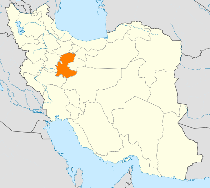
- Mahallat County
-
Mahallat County
شهرستان محلات— County — Coordinates: 33°55′N 50°25′E / 33.917°N 50.417°ECoordinates: 33°55′N 50°25′E / 33.917°N 50.417°E Country  Iran
IranProvince Markazi Capital Mahallat Bakhsh (Districts) Central District Population (2006) – Total 48,458 Time zone IRST (UTC+3:30) – Summer (DST) IRDT (UTC+4:30) Mahallat County can be found at GEOnet Names Server, at this link, by opening the Advanced Search box, entering "9207321" in the "Unique Feature Id" form, and clicking on "Search Database". Mahallat County (Persian: شهرستان محلات) is a county in Markazi Province in Iran. The capital of the county is Mahallat. At the 2006 census, the county's population was 48,458, in 14,139 families.[1] The county has one district: the Central District. The county has two cities: Mahallat and Nimvar.
References
- ^ "Census of the Islamic Republic of Iran, 1385 (2006)" (Excel). Islamic Republic of Iran. http://www.amar.org.ir/DesktopModules/FTPManager/upload/upload2360/newjkh/newjkh/00.xls.
- اطلس گیتاشناسی استانهای ایران [Atlas Gitashenasi Ostanhai Iran] (Gitashenasi Province Atlas of Iran)
 Markazi Province
Capital 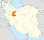
Counties and Cities AshtianFarahan CountyFarmahin · SaruqiKhomeyn CountyKhomeyn · Qurchi BashiKhondab CountyKhondabKomijan CountyKomijan · MilajerdMahallat CountySights Chal nakhjir cave, Delijan · Khorheh · Atashkoh fire temple, Nimvar · Mausoleum of Mahmoud Hessaby ,Tafresh · Arak's grand Bazzar · Mahallat's flower and plant festival · Aveh ancient cite, Saveh · Chaharfasl bath museum, Arak · Hezaveh village · Jameh Mosque of Saveh · Panzdah khordad dam · Emarat lake, Shazand · Azadkhan cave, Mahallat · Mostufi-al-mamalek's castle, Ashtian · Dudahak caravansary, Delijan · Naragh's historical complex · Sepahdar school, Arak · Sheshnaveh mosque · Mahdiabad's Yakhchal ·Categories:- Mahallat County
- Counties of Iran
- Counties of Markazi Province
- Iran geography stubs
Wikimedia Foundation. 2010.