- Cam Brook, Somerset
Geobox River
name = Cam Brook
native_name =
other_name =
other_name1 =
image_size =
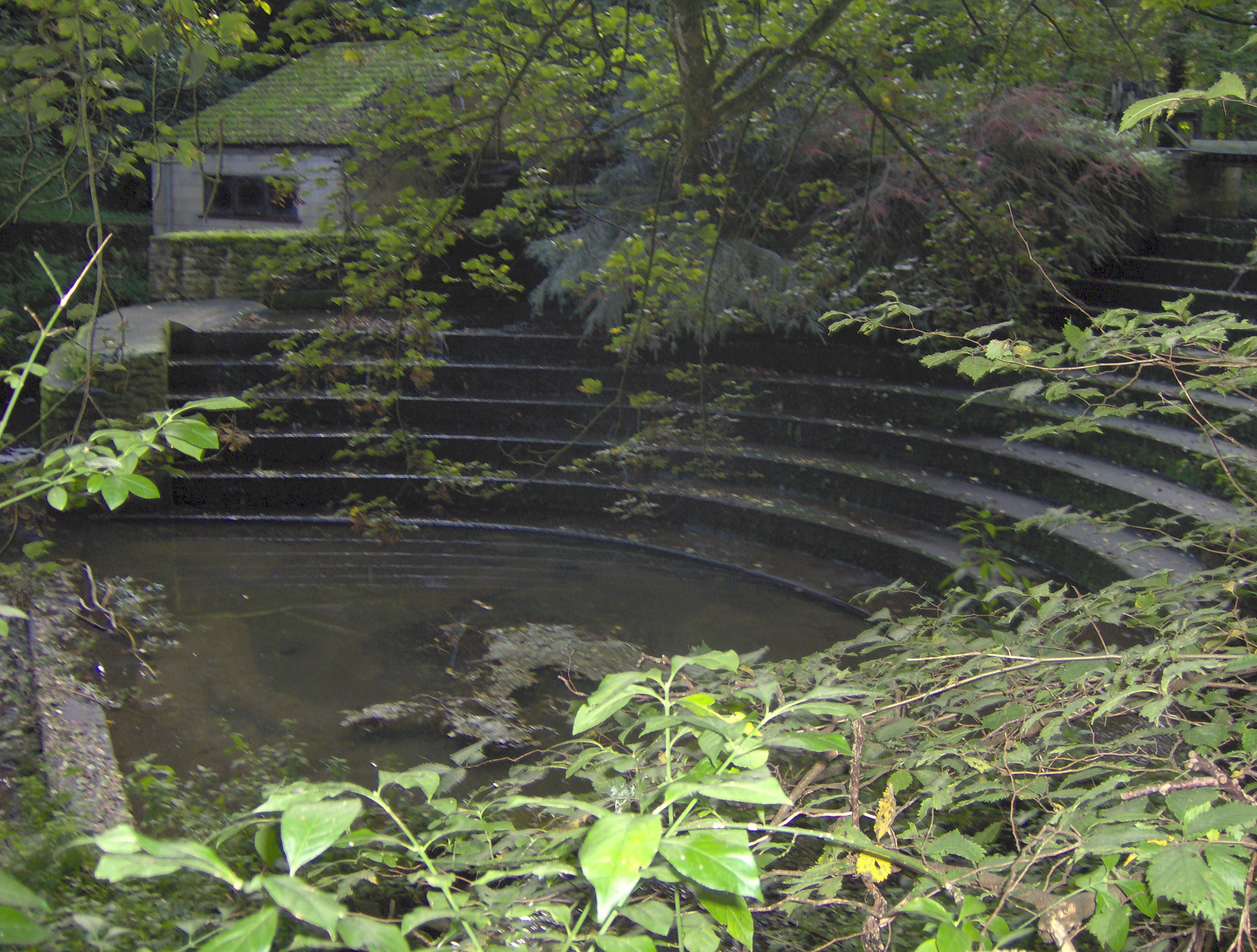
image_caption = Weir on Cam Brook atCombe Hay
etymology =
country = England
country1 =
state = Somerset
state1 =
region =
region1 =
district = Bath and North East Somerset
district1 =
city = Cameley
city1 = Temple Cloud
city2 = Camerton
city3 = Dunkerton
city4 = Combe Hay
landmark =
landmark1 =
length_imperial =
watershed_imperial =
discharge_location =
discharge_imperial =
discharge_max_imperial =
discharge_min_imperial =
discharge1_location =
discharge1_imperial =
source_name =
source_location = Hinton Blewitt
source_district = Bath and North East Somerset
source_region =
source_state = Somerset
source_country = England
source_lat_d = 51
source_lat_m = 18
source_lat_s = 26
source_lat_NS = N
source_long_d = 2
source_long_m = 35
source_long_s = 05
source_long_EW = W
source_elevation_imperial =
source_length_imperial =
mouth_name = Midford Brook
mouth_location = Midford
mouth_district = Bath and North East Somerset
mouth_region =
mouth_state = Somerset
mouth_country = England
mouth_lat_d = 51
mouth_lat_m = 20
mouth_lat_s = 27
mouth_lat_NS = N
mouth_long_d = 2
mouth_long_m = 20
mouth_long_s = 32
mouth_long_EW = W
mouth_elevation_imperial =
tributary_left =
tributary_left1 =
tributary_right =
tributary_right1 =
free_name =
free_value =
map_size =
map_caption = The Cam brook is a small river inSomerset ,England .It rises near
Hinton Blewitt , flows throughCameley ,Temple Cloud , Camerton, Dunkerton andCombe Hay . It then joins the Wellow Brook atMidford to formMidford Brook before joining the River Avon close to theDundas Aqueduct .Along its length are the remains of the
Somerset Coal Canal which originally took its water from Cam brook, and serviced theSomerset coalfield .The valley sides are rounded and undulating through erosion. There are several springs dotted along the valley sides and the resultant streams are often lined with trees. The junction of the valley sides with the base is usually gentle and rounded and the valley floors are narrow but flat with the brooks meandering freely across their flood plain. The brook is quite deep in places and frequently has steep sides. [cite web | title=Area 12 Cam and Wellow Brook Valleys | work=BANES Rural Landscapes | url=http://www.bathnes.gov.uk/BathNES/environmentandplanning/planningservices/Landscape/rlarea12.htm | accessdate=2006-10-09]
Much of the
Ealing comedy "The Titfield Thunderbolt " was shot in the valley on the Camerton branch line, which began nearby, and the cricket scene was filmed near the viaduct hotel atLimpley Stoke .The area is of interest to the
Cam Valley Wildlife Group .References
Wikimedia Foundation. 2010.