- Nenana River
-
 Map
Map
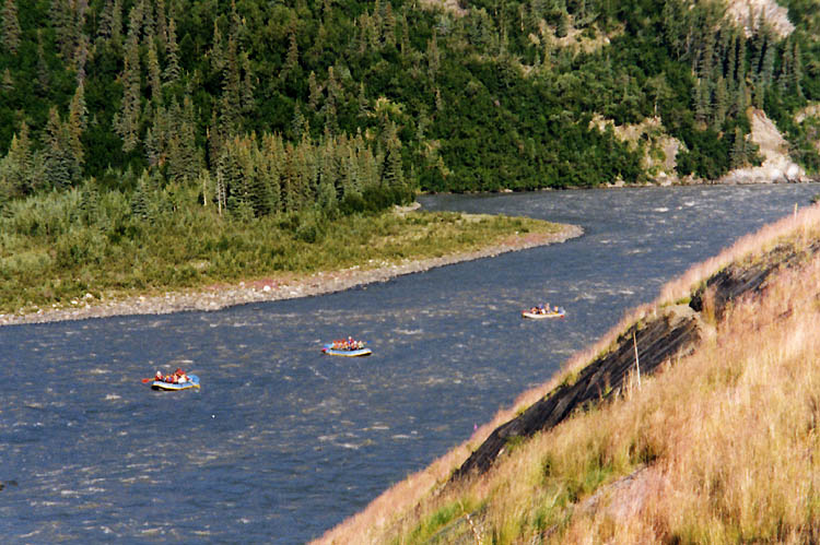
 Rafting on the Nenana River, near Denali National Park
The Nenana River (Lower Tanana: Nina No’) is a tributary of the Tanana River, approximately 150 mi (241 km) long, in central Alaska in the United States. It drains an area on the north slope of the Alaska Range on the south edge of the Tanana Valley southwest of Fairbanks.
It issues from the Nenana Glacier in the northern Alaska Range, southwest of Mount Deborah, approximately 100 mi (160 km) south of Fairbanks. It flows briefly west, then north, forming the eastern boundary of Denali National Park. It emerges from the mountains onto the broad marshy Tanana Valley, joining the Tanana from the south at Nenana, Alaska, approximately 35 mi (56 km) southwest of Fairbanks.
The upper valley of the river furnishes approximately 100 mi (160 km) of the northern route of both the Alaska Railroad and the Parks Highway (Alaska State Highway 3) connecting Fairbanks and Anchorage.
The river was explored in 1885 by Lt. Henry Allen of the United States Army. Allen named it the Cantwell River after Lt. John C. Cantwell, of the Revenue-Cutter Service, who had explored the Kobuk River region in 1884 and 1885. In 1898, W. J. Peters and A. H. Brooks of the USGS, reported that the river was called Tutlut by the natives. The Tanana Indian name was spelled Nenana on a later map.
The river is one of the most popular destinations for whitewater rafting in Alaska.
The river contains Alaska blackfish, arctic grayling, arctic lamprey, broad whitefish, burbot, chum salmon, humpback whitefish, king salmon, lake chubs, least cisco, longnose suckers, northern pike, round whitefish, sheefish, silver salmon, and slimy sculpins.[1] Major archaeological sites located in the valley include Broken Mammoth and Swan Point, of late Pleistocene age.
Contents
Crossings
Location River elevation Remarks Coordinates Mile 216 George Parks Highway 2020 ft Known unofficially as “Number One Bridge” 63°27′24″N 148°48′16″W / 63.45667°N 148.80444°W Mile 231.2 George Parks Highway 1800 ft Crabbie’s Crossing[2] 63°39′22″N 148°50′11″W / 63.65611°N 148.83639°W Mile 238 George Parks Highway 1580 ft 0.7 miles north of Denali National Park access road. South extent of “Glitter Gulch” region. 63°44′14″N 148°53′12″W / 63.73722°N 148.88667°W Mile 242.9 George Parks Highway 1420 ft Known as “Moody Bridge” or “Windy Bridge”; built 174 ft above river. 63°48′9″N 148°56′0″W / 63.8025°N 148.933333°W Healy Spur Road 1280 ft East of Healy, Alaska and south of Usibelli Coal Mine 63°51′15″N 148°57′21″W / 63.85417°N 148.95583°W Mile 275.8 George Parks Highway 680 ft Rex Bridge 64°13′5″N 149°16′51″W / 64.21806°N 149.28083°W See also
- List of Alaska rivers
References
- ^ Alaska Department of Fish and Game. Rivers of the Lower Tanana Management Area, "The Nenana River" Accessed August 6, 2009.
- ^ "Alaska Statutes: Sec. 35.40.045. Crabbie’s Crossing". Justia.com. 1994. Archived from the original on 2011-06-01. http://www.webcitation.org/5z6wT7A08. Retrieved 2011-06-01.
External links
Coordinates: 64°33′53″N 149°06′18″W / 64.56472°N 149.105°W
Categories:- Alaska Range
- Landforms of Denali Borough, Alaska
- Landforms of Matanuska-Susitna Borough, Alaska
- Rivers of Alaska
- Landforms of Yukon–Koyukuk Census Area, Alaska
- Rivers used for whitewater recreation

Wikimedia Foundation. 2010.