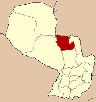
- Concepción Department (Paraguay)
-
Concepción — Department — 
Coordinates: 23°24′S 57°26′W / 23.4°S 57.433°WCoordinates: 23°24′S 57°26′W / 23.4°S 57.433°W Country  Paraguay
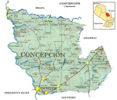
Region Established Capital Concepción Area – Total 18,051 km2 (6,969.5 sq mi) Population (2002) – Total 180,277 – Density 10/km2 (25.9/sq mi) Time zone AST (UTC-04) – Summer (DST) ADT (UTC-03) ISO 3166 code PY-1 Number of Districts 7 Concepción is a department of Paraguay. The capital is the city of Concepción.
Contents
History


Throughout history, this department has suffered a great amount of poblational instability, especially in the times of the colony, due to the advance of the Brazilian “bandeirantes” through the east and the attacks of the Mbayá - Guaicurú natives of Chaco, which, by then, were the lords of that region.
During the later years of the colony, it was organized a great campaign to re-conquest the invaded territories with the intention of defending by populating the region and also with the important task of the Jesuit that founded the city of Belén, of creating a Mission with the Mbayá natives, in the year 1760.
During the governments of Francia and López, the populating process got stronger and the north area of Paraguay became a territory dedicated to cattle. Francia ordered the construction of the penal colony of Tevego in 1813 in the Concepción department.
Once the War Against The Triple Alliance was over, Concepción united with Amambay, constituting a great territory for forestall and yerba plantations.
In the Twentieth Century, Concepción was proclaimed to be the second most important city of the country and it became an active commercial center. Because of its bind with Matto Grosso it experienced important development during that time.
In the year 1906, with the first plan to arrange the national territory, it was proclaimed the first department. Its limits were established with the decree 426 of 1973, as we know them nowadays.
 A church of Horqueta
Limits
Concepción is located in the central part of the oriental region of Paraguay, between the parallels 22°00' y 23°30' South and meridians 58°00' y 56°06' West.
- To the North: The Federative Republic of Brazil, separated by the Apa River, from the mouth of the Paraguay River until the confluence with the Hermoso Stream.
- To the South: San Pedro department, separated by the Ypané River from its confluence with the Guazú Stream until the mouth of the Paraguay River.
- To the East: Amambay department, separated by a straight line that goes from the mouth of the Hermoso Stream with the Apa River to the beginning of the Chacalnica Stream and Negla, and the Aquidabán River to the confluence with the Guazú Stream. From this point another straight line to the confluence of the Ypané-mi and the Ypané rivers to their confluence with the Guazú Stream.
- To the West: Presidente Hayes and Alto Paraguay departments, separated from them by the Paraguay River, between the mouths of the rivers Ypané and Apa.
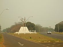 Welcome sign in Horqueta.
Districts
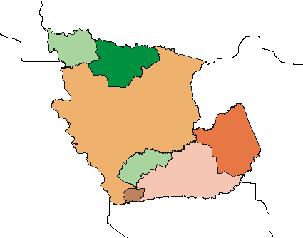
The department is divided in 8 districts:
 San LázaroSan CarlosLoretoBelénYby YaúAzoteyedit] Climate
In summer, the temperature rises to 39º Celsius, and in winter, drops to 2 degrees Celsius. The media is 24 degrees Celsius. The rains can be about 1.324 mm. The rainiest months are November, December and January, and the dryer ones are June, July and August.
Orography and soil
The lands of this territory are of relatively elevation and even more close to the north and east frontiers, where they acquire the characteristic of true mountains. These are lands of calcareous origin, with a diversity of granite rocks and marble. The soil is very fertile. In the center and the north the land is a great territory for pasture, with woods and yerba fields.
In the south, the lands are high, with little pendants and woods.
To the north of the department, there is a succession of hills of low high; the elevations that are continuous form the Cordillera Quince Puntas, along with the mountain rage of San Luis from north to south. The hills: Valle-mi, Medina, Pyta, Naranjahai, Itaipú Guazú and Sarambí, destacate from others.
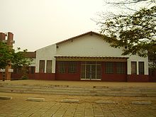
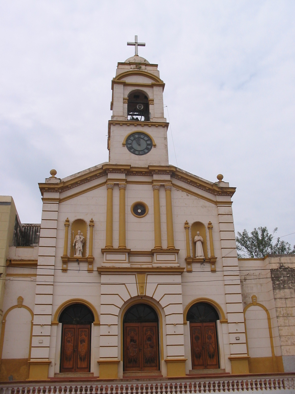
 Concepción's main church
Hydrography
The Paraguay river runs to the west of Concepción along with the minor rivers Apa, Aquidabán e Ypané, and the streams that bathe the territory are: Estrella, Sirena, Apamí, Primero, Quiensabe, Negla, Trementina, Chacalnica, Tapyanguá, Pitanohaga, Guazú, Mbui´i, Ypanemí, Capiibary, Mboi Guazú.
The ports are:
- Port Concepción
- Port Vallemí
- Port Risso: it is mountain passes that produces lime, has rocky coasts, and have had several owners throughout history. There is an antique house built at the end of the 20th century, used to be a defense from the natives of Chaco, still stands in the place.
- Port Fonciere: an important watch point over the Paraguay River. There is a house from the year 1927.
- Por Max: port “Tres Ollas” is nowadays a ganadero establishment, right in front of the Port Pinasco.
- Port Arrecife: it has dangerous reefs. In time of bajada of the Paraguay River, it is ideal for fishing Dorado fish.
- Port Abente: port of cattle ranches, previously called “Port Kemmerich”. It is near the Napeque Stream.
- Port Pagani: today it is abandoned.
- Port Negro: there are some cattle farms.
- Port Algesa: for shipment of goods.
- Port Antiguo: for passengers and shipment of goods.
- Port Itapucumí: in front of the Port Pinasco. Here, the remains of the first lime factory of the country can be found, oldest even from the one in Vallemí. The administrative building of the factory works as a limestone quarry. There work lime ovens and shipments to Asunción are also made.
There is an important watch tower over the Paraguay River and the Vallemí area.
- Port Itapúa: previously called “Calera Cué”. Located opposite Port Fonciere. It has lime ovens and shipping is made to all kind of places from there. Right in front there is an island with beautiful beaches. The population is mainly of working class; there are commercial businesses and a school built with limestone.
- Port Guarati: is a famous limestone factory, about 10 km. from Port Itacuá.
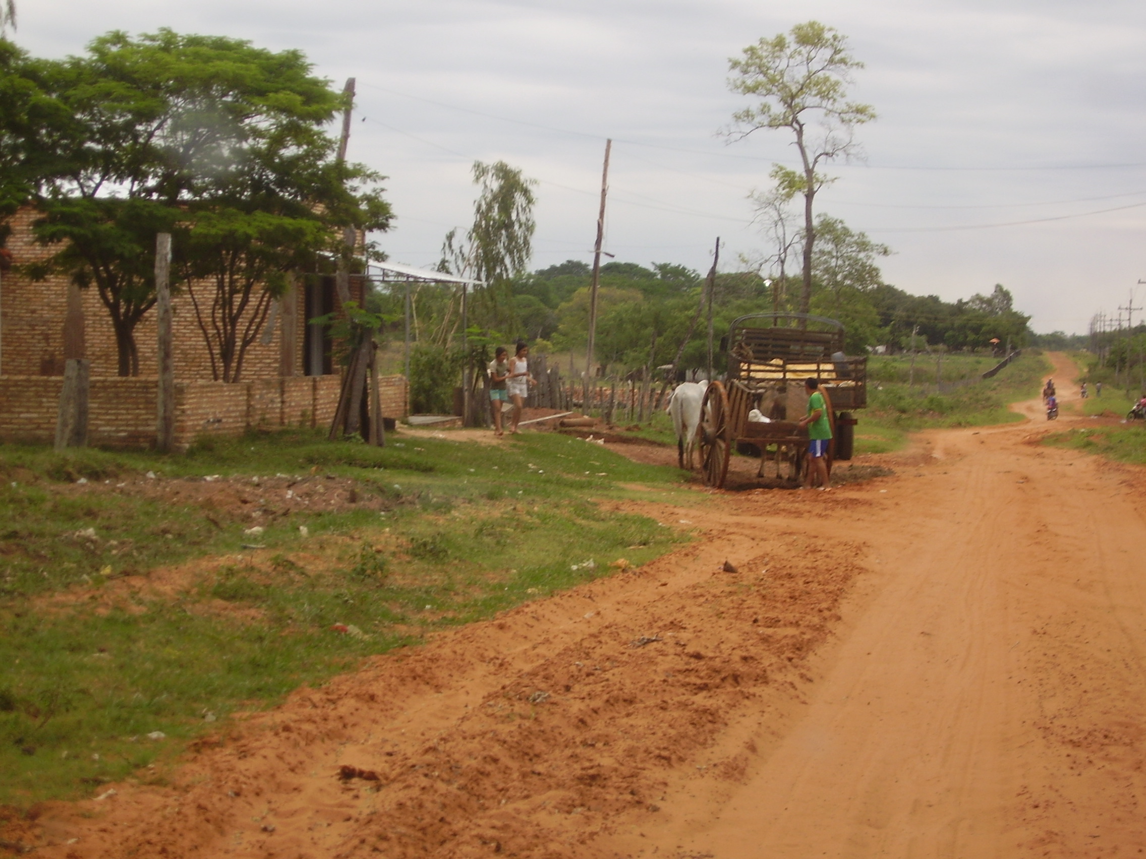
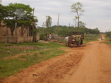 A cart in Yby Yaú
Nature and vegetation
Concepción is set in the ecological region of Aquidabán, a part of region of Amambay and another part in the region of the Central Forest.
The deforestation is a big problem in this department because of the continuous advance of the human activity, creating a great shock to the natural resources of the region. One of the biggest problems is the uncontrolled hunting of animals in the area.
Most of the forestall species are in extinction danger, as do the animals too. The ones that are in more risk of disappearing of the area are: the puma, yaguareté, gua’a pytá (red parrot), gua’a hovy (blue parrot), tucán, tacua guazú, mbo’i jagua, jacaré overo and lobopé.
Some of the protected areas are:
- The San Luis Mountain Range, with an extension of 70.000 hectares
- Itapucumí, with an extension of 45.000 hectares
- Estrella de Concepción, with an extension of 2.400 hectares
- Laguna Negra, with an extension of 10 hectares, this area is in danger nowadays
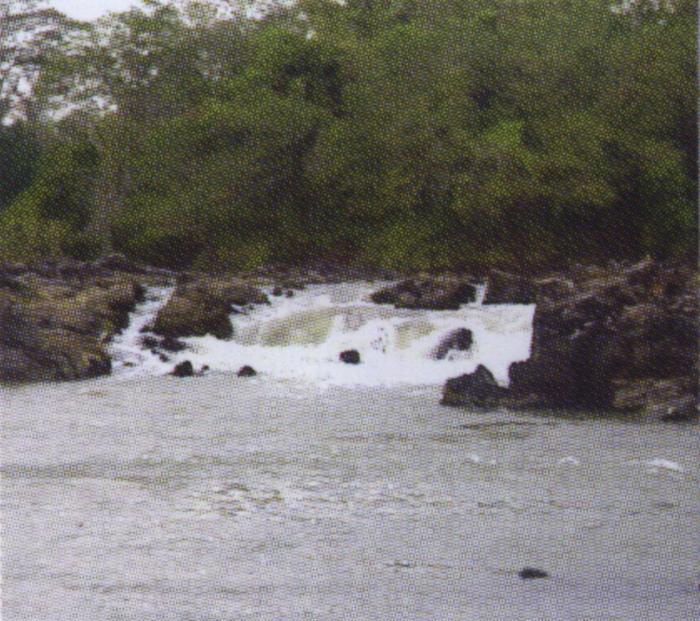
 Rapids over the Apa river
Economy
In agriculture, the most important products are: cotton, sugar cane, maize, wheat and manioc. It is also important the production of locote, sweet potatoes, banana, pepper, tártago, coffee, pineapple, grapefruit and ka’a he’e (a natural sweetener herb).
The silviculture has diminished due to the massive deforestation in this region.
The breeding of animals is the third production of the country, surpassed only by Presidente Hayes and San Pedro’s. The mortality rates for bovine cattle are relatively low. In Concepción is found the largest land of natural pasturing of the Oriental Region. There are also, porcine, ovine and goat cattle in important percentage.
In Vallemí is the Cement National Industry, which has 150 lime extractor plants by the Paraguay River. And near the Apa River quarries of marble are exploit.
There are also other industries such as cold-storage plants, silos, mills and cotton gin industries.
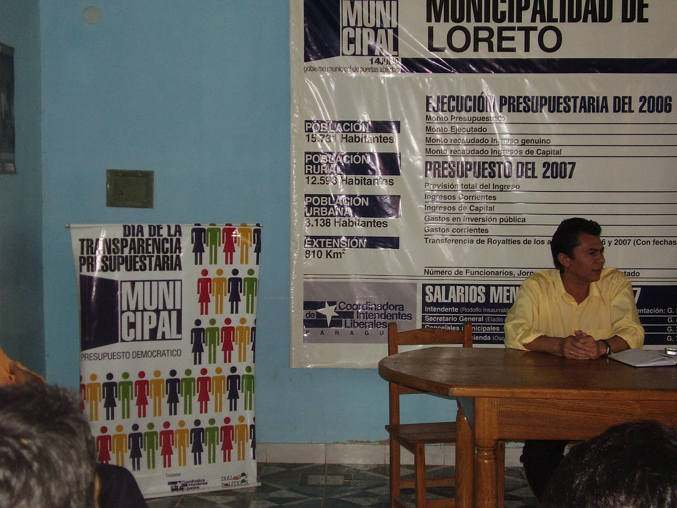
 A municipal reunion in Loreto
Communication and services
The Paraguay River is the most important waterway, because is navigable most of the territory that coasts Concepción, almost 230 km.
The Bioceanic Route cross through the department. The Route 5 "Gral. Bernandino Caballero" communicates with Pedro Juan Caballero and connects with Route 3 “Gral. Elizardo Aquino”, that takes to Asunción.
Another access to the department is through Pozo Colorado, a military depot, which connects with Route 9 “Carlos Antonio Lopez”, also known as "Transchaco Route", in the Paraguayan Chaco.
There is 1.951 km of roads in the entire department; 720 km of them are paved and 146 km of pebbled roads, 362 interdepartmental roads cross it.
The Mcal. Francisco Solano López Airport is located in Concepción City and there are more airways in other districts, and also in the most important cattle establishments.
There is phone service with direct dialed in Concepción City, Horqueta and Yby Yaú; in Belén and Loreto the service is with dialing through an operator.
The ratio stations in AM are: Radio Concepción, Radio Vallemí, Yby Yaú and Guyra Campana. In FM are: Vallemí, Itá Porá, Aquidabán, Los Ángeles, Continental, Belén, Norte Comunicaciones, among others. There are also television stations.
Concepción has 33.976 housings, 13.768 in the urban area and 20.208 in the rural area. There are 1.094 houses with service of running water, and the electricity usage is about 85.082 kilowatts annually.
Education
See also: List of high schools in ConcepciónThere is 190 educational institutions for initial education. In a total of 393 primary schools, there are 39.692 students registered and in 63 high schools there are 9.636 students.
Concepción is seat of the Veterinary Filial Faculty of Asunción National University and the Science and Letters Filial Faculty of the Catholic University.
In the department are institutions that impart classes of Permanent, Special and Technical Education, as well as Docent Formation Institutes.
Health
The department has 64 health institutions; hospitals and health care centers, distributed in the different districts throughout the entire department. This is, without counting the private establishments.
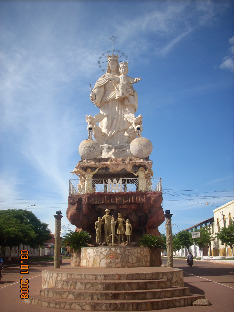
 Entrance to the city of Concepción
Tourism
In Concepción are many places of tourist appealing, which is an important source of income for the department. Once of them is the Tagatiya Stream, a place to do ecological tourism.
Old constructions can be found in Concepción City, capital of the department, these are an example of the historical past of this area. Also a locomotive that worked until 1960 and a truck used in the Chaco War.
Here was located Francisco Solano Lopez barracks, from which he led the troops of Gral. Resquín in a military campaign to Matto Grosso, during the War Against the Triple Alliance.
The Fort San Carlos, in the Apa, is an interesting place to visit. It was built in time of the Colony as a defense mechanism against the invasions of Brazilian Bandeirantes.
The Kurusu Isabel Oratory, a few kilometers away from Concepción, receives many visitants.
A cruise is offered to navigate through the Paraguay River, and all the rivers and streams in the department offer the possibility for practice of many aquatic sports, fishing, navigation and visits to the beaches.
The hills Paso Bravo and San Luis are very visited by tourists. Peña Hermosa Island is a hill of limestone situated in the Paraguay River.
The Aquidabán region has forests and large fields, lagoons, swamps and lakes. In the forest Specimens of Trébol, Timbó, Red Quebracho, Karanda, Palo Blanco, Juasy’y Guazú, Urundey-mi, Kurupa’y, Curuñi, and Jata’i can be found in the forests; in the meadows, specimens of Arasupe; and in palm fields, Karanday.
The Primavera Country House, by the Aquidabán River, has beautiful beaches and lagoons, where people can go camping or ride horses, as well as do outings.
The Ña Blanca Country House, by the Tagatija Guazú, is the center attraction, a stream of crystal clear water, with small waterfalls, where tourists can go swimming and camping.
The JM Ranch has an ample beach by the river and is a nice place to enjoy camping and fishing.
References
- Geografía Ilustrada del Paraguay, Distribuidora Arami SRL; 2007. ISBN 99925-68-04-6
- Geografía del Paraguay, Primera Edición 1999, Editorial Hispana Paraguay SRL.
External links
Alto Paraguay · Alto Paraná · Amambay · Boquerón · Caaguazú · Caazapá · Canindeyú · Central · Concepción · Cordillera · Guairá · Itapúa · Misiones · Ñeembucú · Paraguarí · Presidente Hayes · San PedroCapital District (1)Largest cities Asunción · Ciudad del Este · San Lorenzo · Luque · Capiatá · Lambaré · Fernando de la Mora · Limpio · Ñemby · Encarnación · Mariano Roque Alonso · Pedro Juan Caballero · Villa ElisaMetropolitan areas Categories:
Wikimedia Foundation. 2010.
Look at other dictionaries:
Concepción Department, Argentina — Concepción Department … Wikipedia
Concepción Department — may refer to: Concepción Department (Paraguay) Concepción Department (Argentina) This disambiguation page lists articles about distinct geographical locations with the same name. If an internal … Wikipedia
Concepción — (Spanish for conception , in reference to the Immaculate Conception of Roman Catholic faith) is the name of several towns and cities. The largest of these is Concepción, Chile, the conurbation of which is home to over one million people.… … Wikipedia
Concepción, Paraguay — Concepción City … Wikipedia
San Pedro Department, Paraguay — San Pedro is a department of Paraguay. The capital is the city of San Pedro de Ycuamandiyú.DistrictsThe department is divided in 17 districts:# Antequera # Capiibary # Choré # General Elizardo Aquino # General Isidoro Resquín # Guayaibí #… … Wikipedia
Concepcion — Concepción (spanisch für Empfängnis) oder Concepcion steht für die Unbefleckte Empfängnis Mariens und ist ein häufiger Name in spanischsprachigen Ländern. Er bezeichnet Inhaltsverzeichnis 1 Städte und Verwaltungsregionen 1.1 Europa 1.2 Amerika… … Deutsch Wikipedia
PARAGUAY — PARAGUAY, South American republic; population (est. 2005) 4,960,000, Jewish population 900. A few isolated Jews came to Paraguay from France, Switzerland, and Italy toward the end of the 19th century and merged with the native population without… … Encyclopedia of Judaism
Paraguay — PRY redirects here. For other uses, see PRY (disambiguation). This article is about the country. For other uses, see Paraguay (disambiguation). Republic of Paraguay República del Paraguay (Spanish) Tetã Paraguái … Wikipedia
Paraguay — Paraguayan, adj., n. /par euh gwuy , gway /; Sp. /pah rddah gwuy /, n. 1. a republic in central South America between Bolivia, Brazil, and Argentina. 5,651,634; 157,047 sq. mi. (406,750 sq. km). Cap.: Asunción. 2. a river in central South America … Universalium
Cordillera Department — Cordillera Department Basilica of Caacupé … Wikipedia
- Contact us: Technical Support, Advertising
Concepción Department (Paraguay)

18+
© Academic, 2000-2025
Dictionaries export, created on PHP, Joomla, Drupal, WordPress, MODx.