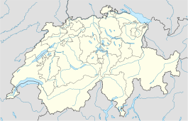
- Cressier, Fribourg
-
For other places with the same name, see Cressier (disambiguation).
Cressier Country Switzerland Canton Fribourg District See Coordinates 46°54′N 7°8′E / 46.9°N 7.133°ECoordinates: 46°54′N 7°8′E / 46.9°N 7.133°E Population 833 (Dec 2009)[1] - Density 200 /km2 (519 /sq mi) Area 4.16 km2 (1.61 sq mi) Elevation 569 m (1,867 ft) Postal code 1785 SFOS number 2257 Surrounded by Courlevon, Gurmels, Jeuss, Münchenwiler (BE), Salvenach, Wallenried Website www.cressier.ch
SFSO statisticsView map of Cressier Cressier is a municipality in the district of See in the canton of Fribourg in Switzerland. Its former German name of Grissach is now in little use.
References
- ^ Swiss Federal Statistical Office, MS Excel document – Bilanz der ständigen Wohnbevölkerung nach Kantonen, Bezirken und Gemeinden (German) accessed 25 August 2010
External links
- Official website (French)
 Media related to Cressier, Fribourg at Wikimedia Commons
- Cressier in German, French and Italian in the online Historical Dictionary of Switzerland.
Barberêche | Bas-Vully | Büchslen | Courgevaux | Courlevon | Courtepin | Cressier | Fräschels | Galmiz | Gempenach | Greng | Gurmels | Haut-Vully | Jeuss | Kerzers | Kleinbösingen | Lurtigen | Meyriez | Misery-Courtion | Muntelier | Murten | Ried bei Kerzers | Salvenach | Ulmiz | Villarepos | Wallenried
Fribourg | Districts of Canton Fribourg | Municipalities of the canton of Fribourg
 Categories:
- Municipalities of the canton of Fribourg
- Municipalities of Switzerland
- Canton of Fribourg geography stubs
Wikimedia Foundation. 2010.

