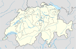
- Courlevon
-
Courlevon Country Switzerland 
Canton Fribourg District See 46°53′N 7°7′E / 46.883°N 7.117°ECoordinates: 46°53′N 7°7′E / 46.883°N 7.117°E Population 294 (Dec 2009)[1] - Density 90 /km2 (233 /sq mi) Area 3.27 km2 (1.26 sq mi) Elevation 556 m (1,824 ft) Postal code 1795 SFOS number 2251 Localities Courlevon, Coussiberlé Surrounded by Courgevaux, Cressier, Münchenwiler (BE), Villarepos, Wallenried Website Courlevon.ch
SFSO statisticsView map of Courlevon Courlevon is a municipality in the district of See in the canton of Fribourg in Switzerland.
It was first recorded in 1214 as Curlivin.
The municipality had 159 inhabitants in 1811, which increased to 210 in 1850 and 276 in 1870. It then fell, to 270 in 1900 and 230 in 1950. Its territory was enlarged in 1974 with the formerly independent municipality Coussiberlé. Thereafter, the population was 207 in 1980 and 259 in 2000.
References
- ^ Swiss Federal Statistical Office, MS Excel document – Bilanz der ständigen Wohnbevölkerung nach Kantonen, Bezirken und Gemeinden (German) accessed 25 August 2010
- Courlevon in German, French and Italian in the online Historical Dictionary of Switzerland.
Barberêche | Bas-Vully | Büchslen | Courgevaux | Courlevon | Courtepin | Cressier | Fräschels | Galmiz | Gempenach | Greng | Gurmels | Haut-Vully | Jeuss | Kerzers | Kleinbösingen | Lurtigen | Meyriez | Misery-Courtion | Muntelier | Murten | Ried bei Kerzers | Salvenach | Ulmiz | Villarepos | Wallenried
Fribourg | Districts of Canton Fribourg | Municipalities of the canton of Fribourg
 Categories:
- Municipalities of the canton of Fribourg
- Municipalities of Switzerland
- Canton of Fribourg geography stubs
Wikimedia Foundation. 2010.

