- Dongola
-
Dongola Location in Sudan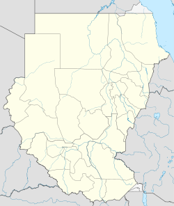
 Dongola
Coordinates: 19°10′11.37″N 30°28′29.62″E / 19.169825°N 30.4748944°E Country  Sudan
SudanState Northern Population (2010) – Total 13,473 This article is about the modern city of Dongola in Sudan. For the modern town in the United States, see Dongola, Illinois. For the site of the abandoned capital of medieval Makouria, see Old Dongola.Dongola (Arabic: دنقلا Dunqulā), also spelled Dunqulah, and formerly known as Al 'Urdi, is the capital of the state of Northern in Sudan, on the banks of the Nile. It should not be confused with Old Dongola, an ancient city located 80 km upstream on the opposite bank.
Dongola is a small, multicultural town, which has given its name to numerous other towns, particularly in the USA. The town is served by Dongola Airport.
The town is home to the University of Dongola, a public university.[1]
Contents
History
Dongola was also a province of Upper Nubia on both sides of the Nile and a centre for Nubian civilization as manifested by its many archaeological remains from the Makurian and Islamic periods. The remains of the revered Baqt Treaty are to be found in Dongola. The province of Dongola was part of the Makuria kingdom, which later became part of Egypt after Muhammad Ali Pasha ordered for the invasion and occupation of Sudan in 1820 after which it was designated as a seat of a pasha.
Dongola was the scene of a victory by General Herbert Kitchener over the indigenous Mahdist tribes in 1896. Dongola Road in the Bishopston area of Bristol was named after this event. So was Dongola Road in Tottenham, North London which runs next to Kitchener Road.
Dongola Racing
The Nile Expedition of 1884–1885 to relieve Gordon at Khartoum passed through the area. Regiments were challenged to race up the river by boat, and this gave rise to the English regatta competition of dongola racing.
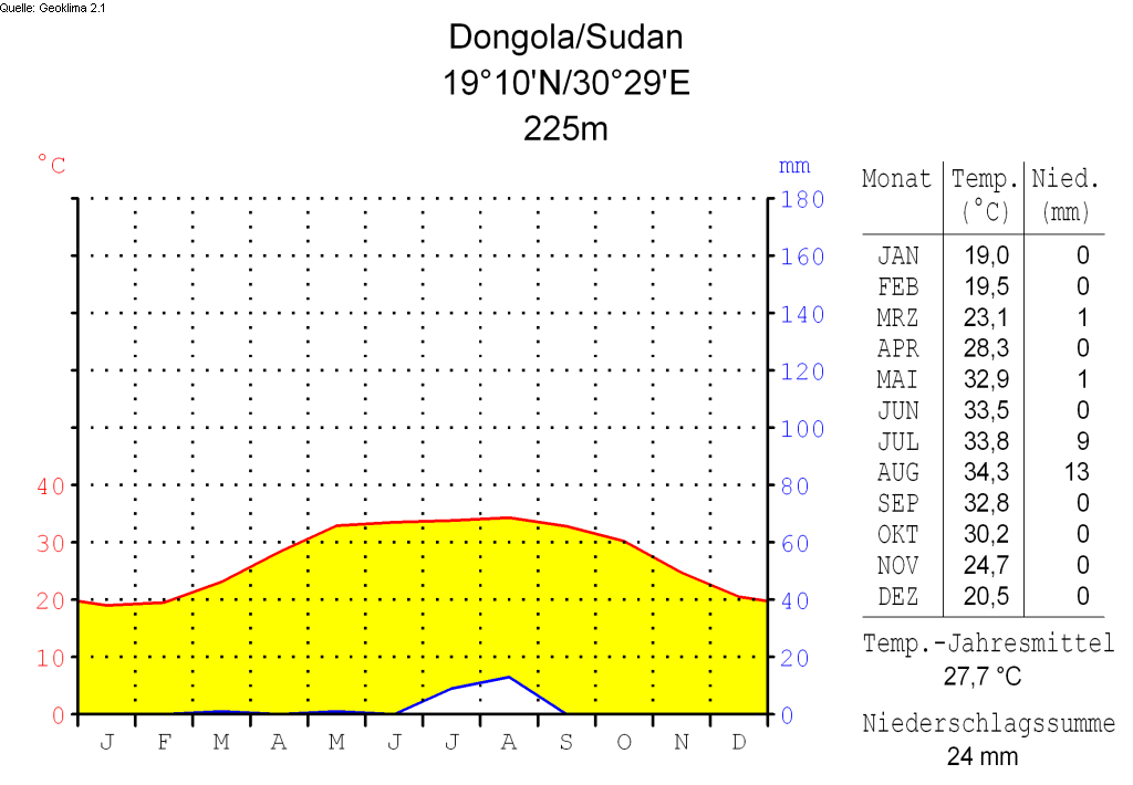
Climate
 Dongola Market
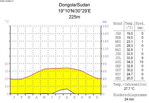
Climate chart translations German: English: Nied. (Niederschlag) = Prec. (Precipitation) Jahresmittel = Annual average Niederschlagssumme = Total annual precipitation References
- ^ "University of Dongala". University of Dongala. http://www.uofd.edu.sd/. Retrieved 2011-09-17.
External links
- "Dongola, Sudan: Climate, Global Warming, and Daylight Charts and Data". Climatecharts.com. Accessed September 2010.
Coordinates: 19°10′11.37″N 30°28′29.62″E / 19.169825°N 30.4748944°E
Categories:- Populated places in Sudan
- State capitals in Sudan
- Northern (state)
- Sudan geography stubs


Wikimedia Foundation. 2010.